
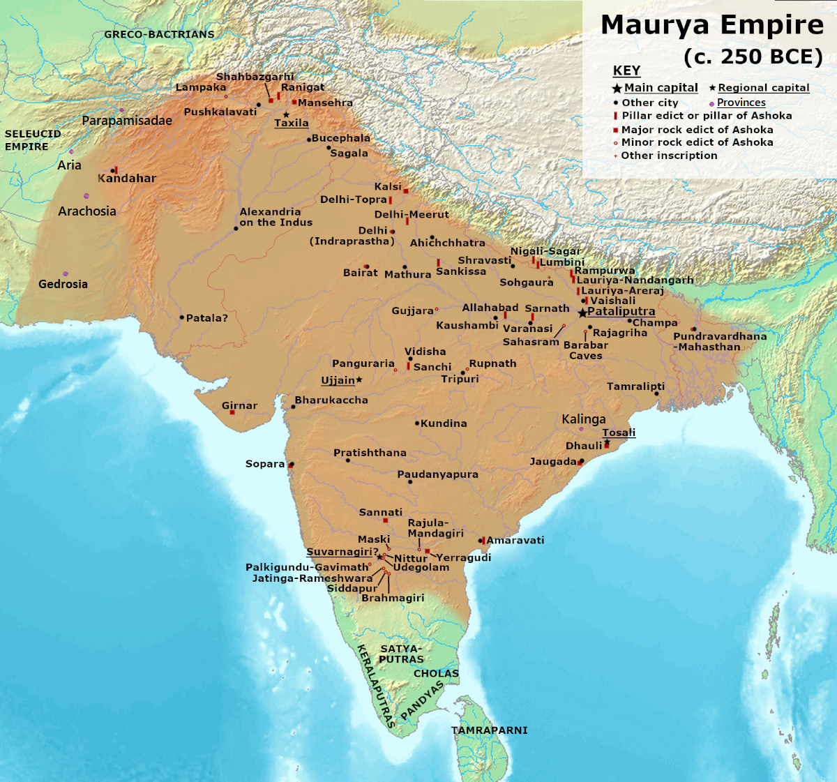
Image: Maurya Empire, c.250 BCE 2
Description: Note: This was the standard "textbook" map of the Maurya Empire. Historians are now arguing that the Maurya Empire did not include large parts of India, which were controlled by autonomous tribes. For such a map, see File:Maurya Empire, c.250 BCE.png. Alternative map of Maurya Empire. Sources: Keay, John (2000). India, a History. New York, United States: Harper Collins Publishers. ISBN 0-00-638784-5. Kulke, H.; Rothermund, D. (2004), A History of India, 4th, Routledge, ISBN 978-0-415-32920-0 Schwartzberg, J. E. (1992), A Historical Atlas of South Asia: University of Oxford Press Background from http://www2.demis.nl/mapserver/mapper.asp Made with GIMP
Author: Avantiputra7
Usage Terms: Creative Commons Attribution-Share Alike 3.0
License: CC-BY-SA-3.0
License Link: http://creativecommons.org/licenses/by-sa/3.0/
Attribution Required?: Yes
Image usage
The following 6 pages link to this image:
