
Image: Mauryan Empire Map
No higher resolution available.
Mauryan_Empire_Map.gif (400 × 337 pixels, file size: 11 KB, MIME type: image/gif)
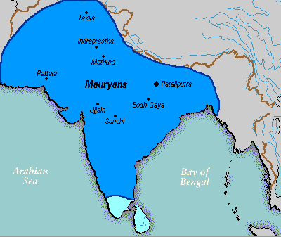
Description: A political map of the Mauryan Empire, including notable cities, such as the capital Pataliputra, and site of the Buddha's enlightenment. this mapis really hard to find txd Green blue represents notable rivers, black represetns modern political borders, and brown represents the border of South Asia. Pataliputra, Sanchi, Ujjain, Bodh Gaya, [[:w:Taxila]|]], Mathura, Indraprastha and Pattala Kaushambi, [pryag] are shown.
Title: Mauryan Empire Map
Credit: Based upon common political maps of the Mauryan Empire, created from this template: Image:Marathas.GIF
Usage Terms: Public domain
License: Public domain
Attribution Required?: No
Image usage
The following 2 pages link to this image:

All content from Kiddle encyclopedia articles (including the article images and facts) can be freely used under Attribution-ShareAlike license, unless stated otherwise.