
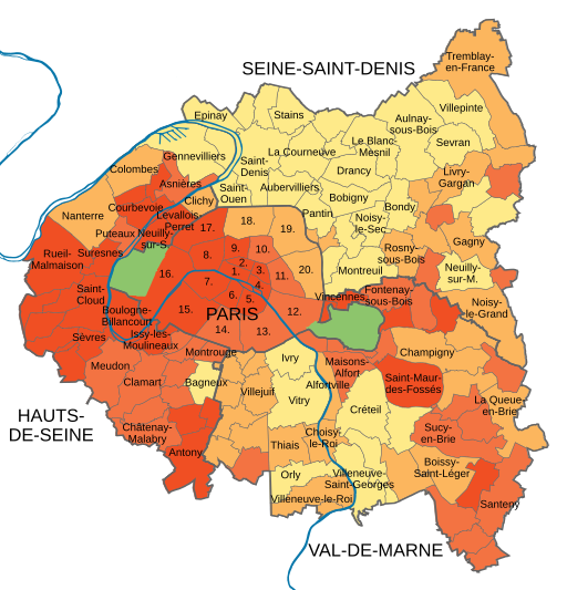
Image: Median income of Paris and inner ring (2018) named

Size of this PNG preview of this SVG file: 512 × 533 pixels. Other resolution: 231 × 240 pixels.
Original image (SVG file, nominally 512 × 533 pixels, file size: 527 KB)
Description: Map showing the median disposable income per municipality in Paris and its Petite couronne (Hauts-de-Seine (No. 92), Seine-Saint-Denis (93) and Val-de-Marne (94)) in 2018 with the numbers of Paris’ arrondissements and the names of some communes.
Title: Median income of Paris and inner ring (2018) named
Credit: Own work based on: Median income of Paris and inner ring (2018).svg
Author: OpenStreetMap contributors, Vascer, GrandEscogriffe
Usage Terms: Creative Commons Attribution-Share Alike 4.0
License: CC BY-SA 4.0
License Link: https://creativecommons.org/licenses/by-sa/4.0
Attribution Required?: Yes
Image usage
The following page links to this image:

All content from Kiddle encyclopedia articles (including the article images and facts) can be freely used under Attribution-ShareAlike license, unless stated otherwise.
_named.svg)