
Image: Megi 2010-10-18 0235Z

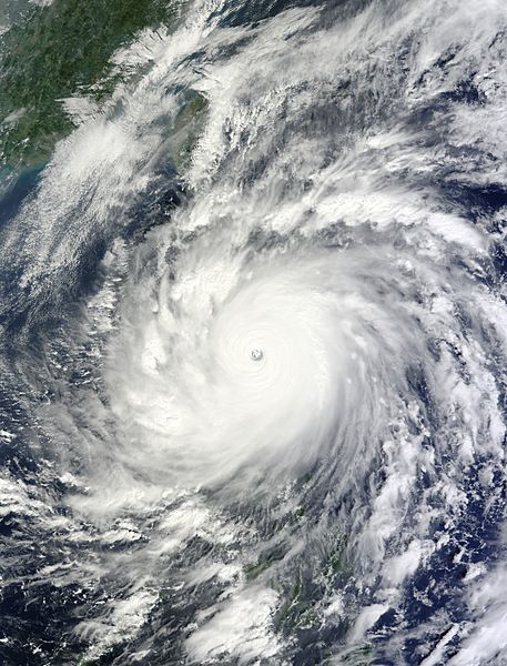
Description: On October 18, 2010, Typhoon Megi approached and made landfall in the northeastern Isabela Province of the Philippines. Spanning more than 600 kilometers (370 miles) across, it was the most intense tropical cyclone of the year to date. This image was taken by the Moderate Resolution Imaging Spectroradiometer (MODIS) on NASA’s Terra satellite at 10:35 a.m. Philippine Time (02:35 UTC) on October 18, 2010. The official international name of the storm is Megi, which means “catfish” in Korean. But the storm is known locally as Juan, as the Philippine Atmospheric, Geophysical and Astronomical Services Administration has its own naming system.
Title: Megi 2010-10-18 0235Z
Credit: http://earthobservatory.nasa.gov/NaturalHazards/view.php?id=46425
Author: NASA image by Jeff Schmaltz, MODIS Rapid Response Team, Goddard Space Flight Center
Usage Terms: Public domain
License: Public domain
Attribution Required?: No
Image usage
The following 3 pages link to this image:
