
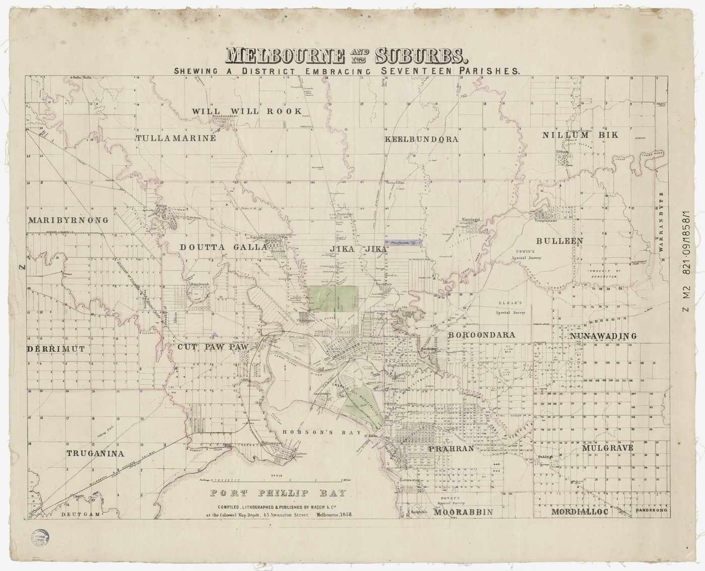
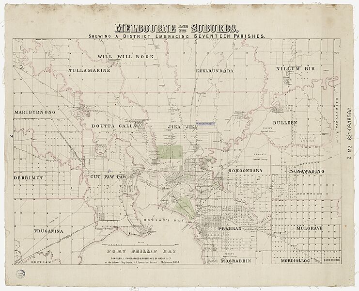
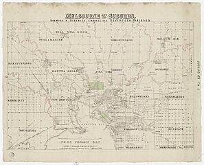
Image: Melbourne and its suburbs, shewing (sic) a district embracing seventeen parishes, 1858
Description: Title: Melbourne and its suburbs [cartographic material] : shewing a district embracing seventeen parishes / compiled, lithographed and published by Mason & Co. Author / Creator: Mason & Co. Date: 1858 Notes: Area: Covers the parishes of Will Will Rook, Tullamarine, Keelbundora, Nillum Bik, Maribyrnong, Doutta Galla, Jika Jika, Bulleen, Derrimut, Cut Paw Paw, Booroondora, Nunawading, Truganina, Prahran, Mulgrave, Mordialloc and Dandenong. At foot of map: Compiled, lithographed & published by Mason & Co. at the Colonial Map Dépôt, 45 Swanston Street Melbourne, 1858. Cadastral map showing parishes and suburbs of Melbourne, railways, telegraph, public buildings, hotels, parks and reserves, rivers and creeks, allotments and roads. Contents: 1 map : hand col., mounted on linen ; 42 x 62 cm, on sheet 54 x 67 cm. Publisher: Melbourne : Mason & Co., 1858. Subjects: Land subdivision -- Victoria -- Melbourne Region -- Maps Land tenure -- Victoria -- Melbourne Region -- Maps Parishes -- Victoria -- Melbourne Region -- Maps Railroads -- Victoria -- Maps Real property -- Victoria -- Melbourne Region -- Maps Melbourne (Vic.) -- Maps Melbourne Region (Vic.) -- Maps Cadastral maps Source: State Library NSW
Title: Melbourne and its suburbs, shewing (sic) a district embracing seventeen parishes, 1858
Credit: https://www.flickr.com/photos/monlib/50556509618/
Author: Monash Public Library Service
Usage Terms: Public domain
License: Public domain
Attribution Required?: No
Image usage
The following page links to this image:

_a_district_embracing_seventeen_parishes,_1858.jpg)