
Image: Merwede map
Size of this preview: 800 × 355 pixels. Other resolutions: 320 × 142 pixels | 4,000 × 1,774 pixels.
Original image (4,000 × 1,774 pixels, file size: 4.49 MB, MIME type: image/png)
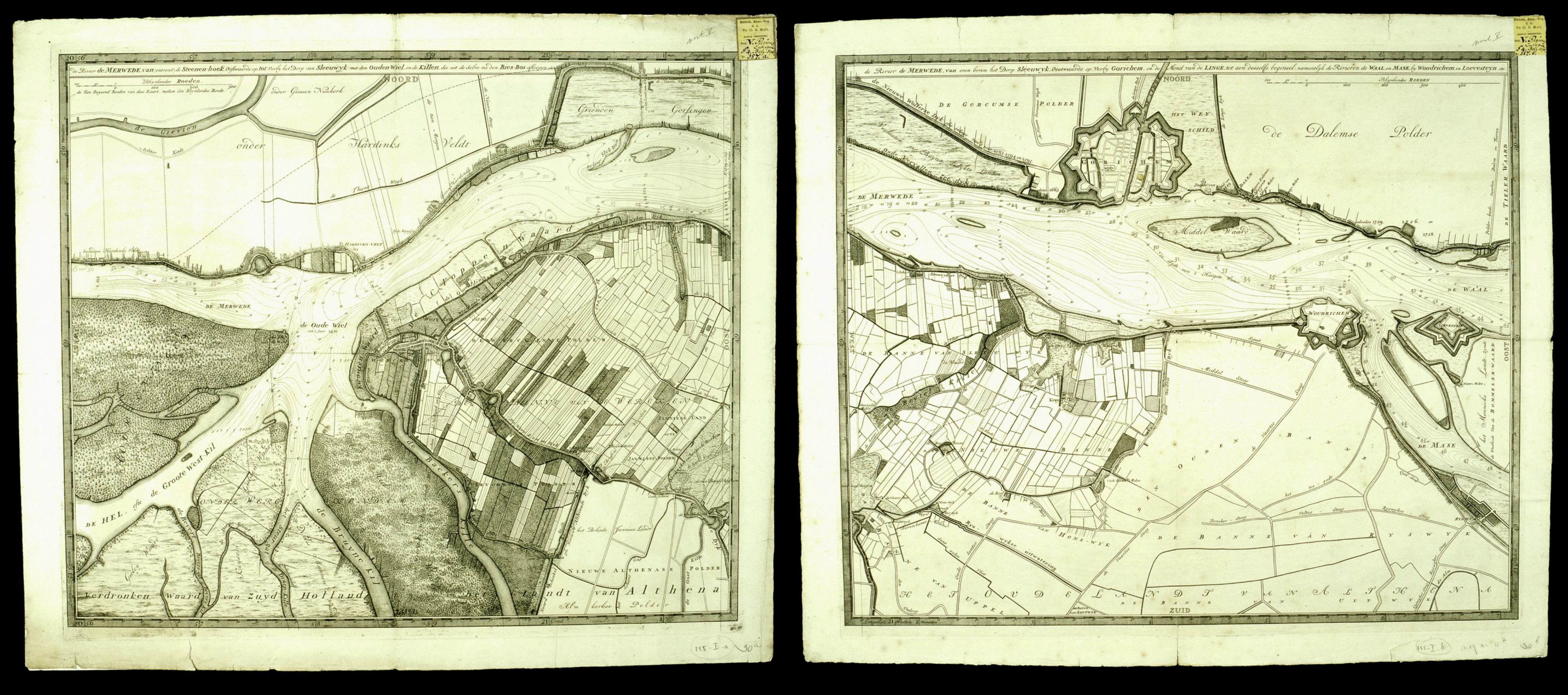
Description: The 1729-30 map of the Merwede River in the Netherlands, credited by the Encyclopædia Britannica, 11th ed.'s "Map" article as the first full-scale use of isobath lines.
Title: Merwede map
Credit: De Rivier de Merwede, van ontrent de Steenen-hoek, Oostwaards-op tot verby het dorp van Sleeuwyk, held by the University of Utrecht
Author: Nicolaas Samuelszoon Kruik
Usage Terms: Public domain
License: Public domain
Attribution Required?: No
Image usage
The following page links to this image:

All content from Kiddle encyclopedia articles (including the article images and facts) can be freely used under Attribution-ShareAlike license, unless stated otherwise.