
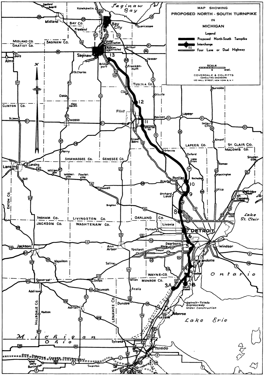
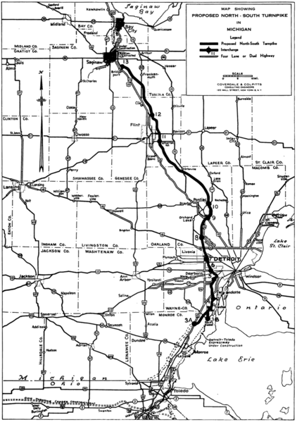
Image: Michigan Turnpike map 1955
Size of this preview: 422 × 599 pixels. Other resolutions: 169 × 240 pixels | 1,034 × 1,468 pixels.
Original image (1,034 × 1,468 pixels, file size: 5.79 MB, MIME type: image/png)
Description: Map of the proposed Michigan Turnpike from 1955
Usage Terms: Public domain
Image usage
The following page links to this image:

All content from Kiddle encyclopedia articles (including the article images and facts) can be freely used under Attribution-ShareAlike license, unless stated otherwise.