
Image: Misak-i milli
Size of this preview: 800 × 493 pixels. Other resolutions: 320 × 197 pixels | 1,474 × 909 pixels.
Original image (1,474 × 909 pixels, file size: 68 KB, MIME type: image/png)
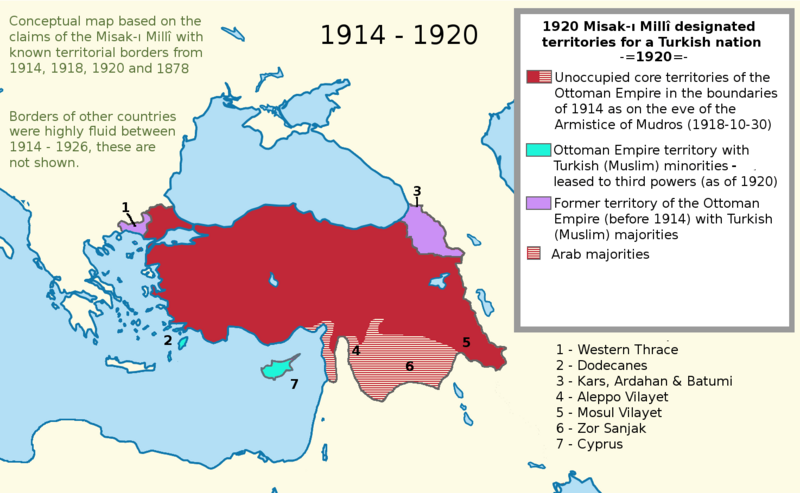
Description: I worked more on the proposal map and I also added the current territories. This map shows the goal of the Turkish side. I used a Wikipedia map while I was working on this project. It is called "LocationTurkey2". --Please help me erasing the older one (Misak-ı_milli.PNG)-- Turkish variation: File:Misak-i_milli_tr.png
Title: Misak-i milli
Credit: Transferred from en.wikipedia to Commons.
Author: Deliogul at English Wikipedia
Usage Terms: Creative Commons Attribution-Share Alike 3.0
License: CC BY-SA 3.0
License Link: http://creativecommons.org/licenses/by-sa/3.0/
Attribution Required?: Yes
Image usage
The following page links to this image:

All content from Kiddle encyclopedia articles (including the article images and facts) can be freely used under Attribution-ShareAlike license, unless stated otherwise.