
Image: Mississippi River Lock and Dam number 15

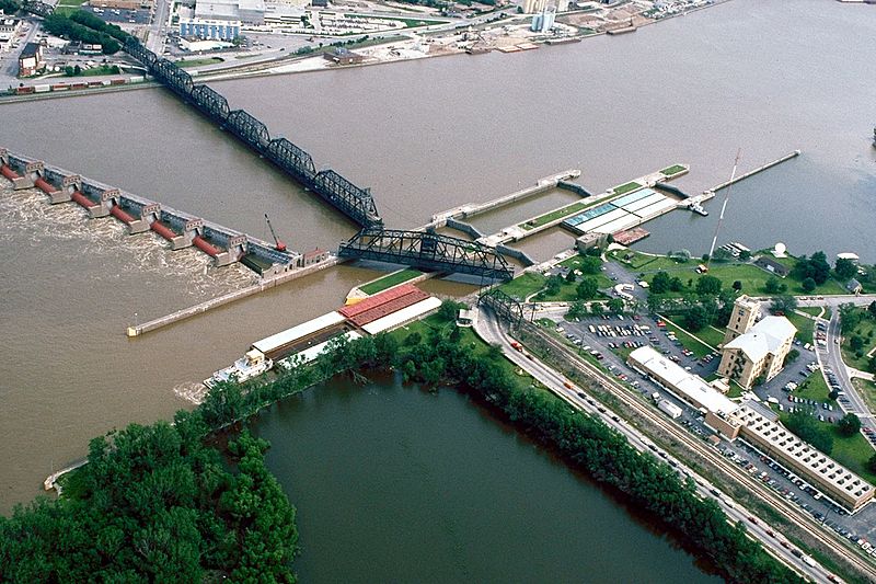
Description: Aerial view of Lock and Dam No. 15 on the Mississippi River between Rock Island, Illinois and Davenport, Iowa. View is from the Illinois side of the river looking northwest to Iowa. The Government Bridge, a combined auto and railroad bridge, spans the river right over the locks, necessitating a turntable drawbridge to clear the locks. Rock Island District Office is also located here. Location: Rock Island, Illinois, 41°31′07″N 90°34′08″W / 41.51861°N 90.56889°W / 41.51861; -90.56889
Title: Mississippi River Lock and Dam number 15
Credit: US Army Corps of Engineers Digital Visual Library (DVL) Image description Image page
Author: US Army Corps of Engineers, Carol Arney
Permission: This image or file is a work of a U.S. Army Corps of Engineers soldier or employee, taken or made as part of that person's official duties. As a work of the U.S. federal government, the image is in the public domain. English | italiano | Nederlands | русский | Türkçe | українська | +/−
Usage Terms: Public domain
License: Public domain
Attribution Required?: No
Image usage
The following 3 pages link to this image:
