
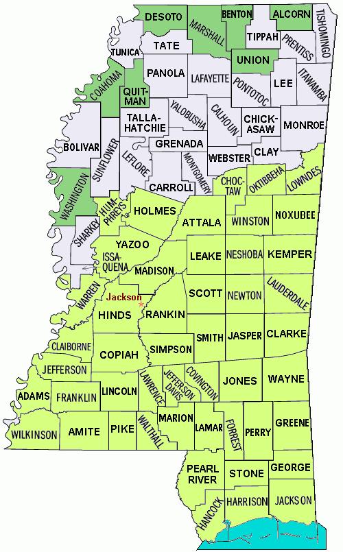
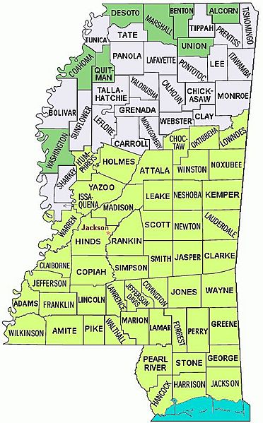
Image: Mississippi counties map Katrina disaster areas
Description: Hurricane Katrina Mississippi disaster areas: Map of the state of Mississippi showing borders and names of the counties, with disaster areas from Hurricane Katrina shaded: all counties in Mississippi were declared disaster areas on 10/27/2005, with 49 counties for full Federal assistance (FEMA). The file is in JPEG format for rapid display, due to auto-resizing smaller.
Title: Mississippi counties map Katrina disaster areas
Credit: (Wikipedia): en:Image:Mississippi counties map.png (edited to shade counties, converted to JPEG format, with white background trimmed).
Author: self
Usage Terms: Creative Commons Attribution-Share Alike 3.0
License: CC-BY-SA-3.0
License Link: http://creativecommons.org/licenses/by-sa/3.0/
Attribution Required?: Yes
Image usage
The following page links to this image:
