
Image: Mitchell Map 1 quarter north west

Size of this preview: 800 × 569 pixels. Other resolutions: 320 × 227 pixels | 5,986 × 4,255 pixels.
Original image (5,986 × 4,255 pixels, file size: 20.62 MB, MIME type: image/jpeg)
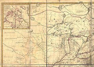
Description: North west quarter of Mitchell Map - A map of the British and French dominions in North America,...; 1757
Title: Mitchell Map 1 quarter north west
Credit: File:Mitchell Map-06full2.jpg
Author: John Mitchell; digital version, Library of Congress, Geography and Map Division
Usage Terms: Public domain
License: Public domain
Attribution Required?: No
Image usage
The following page links to this image:

All content from Kiddle encyclopedia articles (including the article images and facts) can be freely used under Attribution-ShareAlike license, unless stated otherwise.