
Image: Mobile1725
Size of this preview: 800 × 594 pixels. Other resolutions: 320 × 238 pixels | 1,292 × 960 pixels.
Original image (1,292 × 960 pixels, file size: 980 KB, MIME type: image/jpeg)
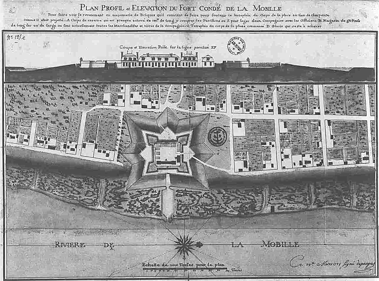
Description: Mobile, Alabama in 1725. Profile and Elevation Map of Fort Condé at Mobile.
Title: Mobile1725
Credit: Original document in the University of South Alabama Archives, Mobile, Alabama, USA. Transferred from en.wikipedia
Author: Adrien de Pauger (He also designed the Vieux Carré in en:New Orleans, Louisiana )
Usage Terms: Public domain
License: Public domain
Attribution Required?: No
Image usage
The following 4 pages link to this image:

All content from Kiddle encyclopedia articles (including the article images and facts) can be freely used under Attribution-ShareAlike license, unless stated otherwise.