
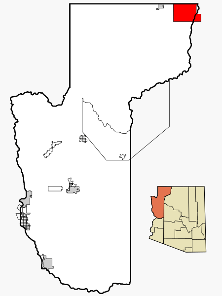
Image: Mohave County Incorporated and Unincorporated areas Kaibab highlighted

Description: This map shows the incorporated and unincorporated areas and Indian reservations in Mohave County, Arizona, highlighting Kaibab in red, which also delimits the geographically identical Kaibab Indian Reservation . I created it in Inkscape using data from the US Census Bureau and the Mohave County website.
Title: Mohave County Incorporated and Unincorporated areas Kaibab highlighted
Credit: My own work, based on public domain information. Based on similar map concepts by Ixnayonthetimmay
Author: Arkyan
Permission: Copyleft-type licensing. See below.
Usage Terms: Creative Commons Attribution-Share Alike 3.0
License: CC-BY-SA-3.0
License Link: http://creativecommons.org/licenses/by-sa/3.0/
Attribution Required?: Yes
Image usage
The following 2 pages link to this image:
