Kaibab Indian Reservation facts for kids
Quick facts for kids
Kaibab Indian Reservation
Kai'vi'vits (Ute-Southern Paiute)
|
|
|---|---|

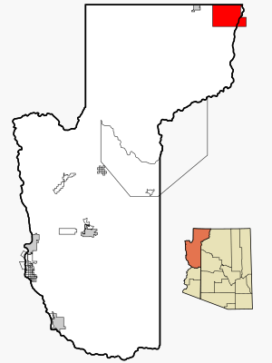
The reservation in Mohave County, with its southeastern corner shown extending into adjacent Coconino County
|
|
 |

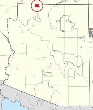
The Kaibab Indian Reservation is the special home of the Kaibab Band of Paiute Indians. This group is a federally recognized tribe of Southern Paiute people. Their language is called Kai'vi'vits in Southern Paiute. The reservation is located in northern Arizona, a state in the United States. It covers about 188.75 square miles (488.88 square kilometers). This land is mostly in Mohave County and Coconino County. It is very close to the southern border of Utah.
Inside the reservation, you can find the Pipe Spring National Monument. This is a historic site. The Thunder Mountain Pootseev Dark-sky preserve is also part of the reservation. This means the area is protected to keep its night sky dark for stargazing.
In the year 2000, 196 people lived on the Kaibab Indian Reservation.
Contents
History of the Kaibab Paiute People
Historically, the Kaibab Southern Paiute were a group who moved around. They lived in what is now northern Arizona and southern Utah. They were one of the last Native American groups to face European settlers.
Their food came from the many plants and animals in their land. They ate cacti, berries, fruits, and roots. They also hunted rodents, big cats, reptiles, and other animals. The Kaibab Paiute people used their steady water sources to water their gardens. They grew important crops like maize (corn), beans, and squash. They got water from the Kanab Creek and springs near the Vermillion Cliffs.
In the 1860s, Mormon settlers arrived. They took control of the Kaibab Paiute's main water sources. This made it very hard for the Kaibab Paiute people to survive. Many people died, mostly from not having enough food.
In 1909, the Kaibab Indian Reservation was officially created. Today, it is home to the Kaibab Paiute people.
Geography of the Reservation
The U.S. Census Bureau says the reservation has a total area of 188.75 square miles (488.88 square kilometers). Almost all of this area is land.
People of the Kaibab Indian Reservation
In the year 2000, there were 196 people living on the reservation. These people made up 65 households and 49 families. The population was about 1 person per square mile. There were 88 homes available.
About 23.5% of the people were White. About 66.8% were Native American. Some people were from other races (4.6%) or from two or more races (5.1%). No one identified as Black, African American, Asian, or Pacific Islander. About 10.2% of the people were Hispanic or Latino.
Many households (61.5%) had children under 18 living with them. About 36.9% were married couples. About 32.3% were female householders without a husband. About 24.6% were not families. Most households (23.1%) had only one person. Only 1.5% had someone living alone who was 65 or older. The average household had about 3 people. The average family had about 3.5 people.
The population was quite young. About 44.4% were under 18 years old. About 9.7% were 18 to 24. About 24.5% were 25 to 44. About 19.9% were 45 to 64. Only 1.5% were 65 or older. The average age was 22 years. For every 100 females, there were about 73 males.
The average income for a household on the reservation was $20,000. For families, the average income was $21,250. About 29.69% of families and 31.65% of the population had lower incomes.
Education on the Reservation
The Fredonia-Moccasin Unified School District serves the students living on the reservation.
 | Bayard Rustin |
 | Jeannette Carter |
 | Jeremiah A. Brown |

