
Image: Moll World Map 1719 master-gmd-gmd3-g3200-g3200-mf000001Z Atlantic
Size of this preview: 479 × 600 pixels. Other resolutions: 192 × 240 pixels | 3,447 × 4,317 pixels.
Original image (3,447 × 4,317 pixels, file size: 4.55 MB, MIME type: image/jpeg)
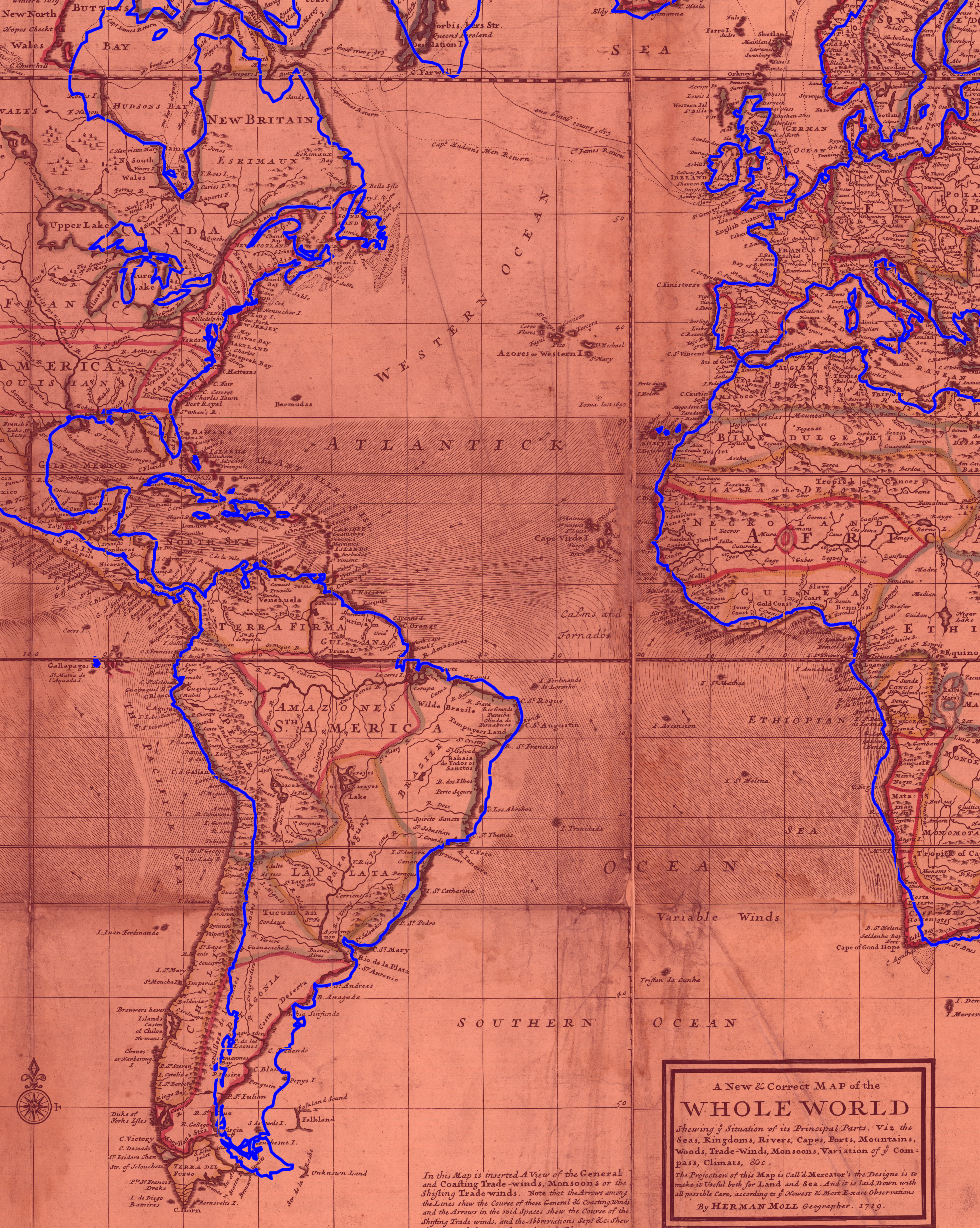
Description: Detail from File:Moll World Map 1719 Alignment with modern map outline.jpg, superimposing a modern Mercator world map over a 1719 Mercator world map by Herman Moll. The details shows the (mis)alignment of the shores of the Atlantic Ocean, chiefly an artifact of continuing difficulty computing longitude at sea.
Title: Moll World Map 1719 master-gmd-gmd3-g3200-g3200-mf000001Z Atlantic
Credit: Own work
Author: Kognos
Usage Terms: Creative Commons Attribution-Share Alike 4.0
License: CC BY-SA 4.0
License Link: https://creativecommons.org/licenses/by-sa/4.0
Attribution Required?: Yes
Image usage
The following page links to this image:

All content from Kiddle encyclopedia articles (including the article images and facts) can be freely used under Attribution-ShareAlike license, unless stated otherwise.