
Image: MonklandCanalDrumpellerCollieryBasin

Size of this preview: 800 × 600 pixels. Other resolutions: 320 × 240 pixels | 2,560 × 1,920 pixels.
Original image (2,560 × 1,920 pixels, file size: 2.88 MB, MIME type: image/jpeg)
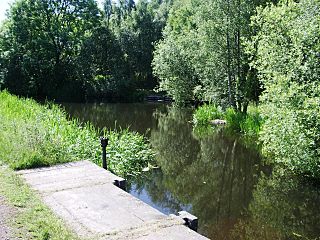
Description: Monkland Canal at the abandoned Drumpeller Colliery basin. Looking west from 55°51′44.2″N 4°3′54.2″W / 55.862278°N 4.065056°W / 55.862278; -4.065056. Foreground shows sluice gate to feed Bishop Burn.
Title: MonklandCanalDrumpellerCollieryBasin
Credit: Own work
Author: ML5
Usage Terms: Public domain
License: Public domain
Attribution Required?: No
Image usage
The following page links to this image:

All content from Kiddle encyclopedia articles (including the article images and facts) can be freely used under Attribution-ShareAlike license, unless stated otherwise.