
Monkland Canal facts for kids
Quick facts for kids Monkland Canal |
|
|---|---|

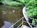
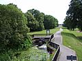
Weir at Old Palacecraig
|
|
| Specifications | |
| Maximum boat length | 71 ft 0 in (21.64 m) |
| Maximum boat beam | 14 ft 0 in (4.27 m) |
| Locks | 1 descent of four double locks; two other locks (The descent was duplicated for a period by a rope-worked inclined plane) |
| Status | Unnavigable, partly culverted |
| History | |
| Original owner | Monkland Canal Company |
| Principal engineer | James Watt |
| Date of act | 1770 |
| Date of first use | Progressively from 1771 |
| Date closed | 1942 |
| Geography | |
| Start point | Calderbank, near Airdrie |
| End point | Townhead Basin, Glasgow (Later connected to the Forth and Clyde Canal by the "cut of junction") |
| Branch(es) | Four short branches |
| Connects to | Forth and Clyde Canal |
The Monkland Canal was a waterway about 12+1⁄4-mile-long (19.7 km) in Scotland. It was built to transport coal from the mining areas of Monklands to the growing city of Glasgow. Construction started in 1771, and sections opened as they were finished.
By 1794, the canal reached its full planned length, connecting coal pits at Calderbank to a basin in Townhead, Glasgow. At first, there were two separate parts of the canal with a 96-foot (29 m) height difference at Blackhill. Coal had to be unloaded from boats, carried across the land, and then reloaded onto new boats.
Later, special water lifts called locks were built to connect the two sections. The canal also linked up with the Forth and Clyde Canal, which helped it get even more business. Keeping enough water in the canal was always a challenge. To save water, an "inclined plane" was built at Blackhill. This was like a ramp where boats could be moved up and down while floating in special containers called caissons. It was quicker than using locks and was used all year round.
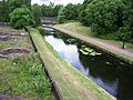
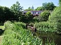
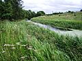
In the 1800s, new ways of making iron were discovered, and there was lots of iron and coal in the Coatbridge area. The Monkland Canal was perfectly placed to carry these raw materials and finished products. However, when railways became popular, they offered faster transport, and the canal became less competitive. It stopped being used for boats in 1952. Today, parts of the canal are hidden underground, but they still supply water to the Forth and Clyde Canal. Much of its old path is now under the M8 motorway. Still, two sections of the canal remain open and are popular for fishing.
Contents
Building the Monkland Canal
The idea for the Monkland Canal came about because coal prices in Glasgow were very high. Coal was needed for heating homes and for industries. In 1768, the city leaders of Glasgow asked a famous inventor and engineer, James Watt, to find the best route for a canal.
James Watt's Plan
In 1769, James Watt suggested two routes. One was very expensive and would need many locks to change the water level. Watt preferred a cheaper plan that would bring the canal close to Glasgow without locks. This plan, costing about £10,000, was approved in 1770. The company building the canal was allowed to raise money by selling shares.
Starting Construction
Building the canal was very difficult. James Watt oversaw the work, which began in 1770. He found it hard to find skilled workers, and contractors often struggled to do the job right. Watt himself found managing the construction stressful. He wrote about the "desperate weather" and "nastiness of our clay grounds."
The canal was planned to be 3 feet (0.91 m) deep, but after advice from another engineer, John Smeaton, it was made 4 feet (1.2 m) deep instead. This made it suitable for larger boats, up to 71 by 14 feet (21.6 by 4.3 m).
Early Openings and Challenges
As parts of the canal were finished, they were used right away. In 1771, coal boats started using the section near Langloan. By 1772, boats were reaching Netherhouse. James Watt noted that about four and a half miles [7.2 km] of the canal were open and in use by late 1772.
However, the company ran out of money before the canal was fully built. James Watt left the project in 1773. The canal was not making enough money, and the company was in debt. This was a tough time because the American War of Independence had hurt many Glasgow businesses. Some people even joked about filling the canal in because it seemed like a bad investment!
Extending the Canal Westward
By 1782, the canal reached Gartcraig, but it still didn't go all the way to Glasgow. New owners decided to extend it closer to the city, to a basin at Townhead. This extension was finished quickly.
At Blackhill, there was still a big height difference between the two parts of the canal. Coal had to be moved from one boat to another using an "inclined plane," which was a slope where coal boxes were moved up and down. This was a slow process.
Connecting to Other Canals
In 1786, Andrew Stirling, a major shareholder, saw the potential for the canal. He realized that connecting the Monkland Canal to the Forth and Clyde Canal would be a great idea. This connection would also help supply water to the Forth and Clyde Canal, which was important.
In 1790, a new law allowed the two canals to build a "cut of junction" to connect them. The Forth and Clyde Canal paid for this new section. The extension of the Monkland Canal to the River Calder was completed in 1792.
The Blackhill locks, which allowed boats to move between the different levels, took longer to build. They were finished in 1793 or 1794. There were four "double locks," meaning two lock chambers side-by-side, which helped boats go up or down a total of 96 feet (29 metres).
Life on the Canal
Once the canal was fully connected and had its locks, it became very successful. Coal from Monkland could now easily reach Glasgow, and its price went up. By 1792, coal that once sold for 6 pence per cart was now 18 pence!
Canal Boats
The boats used on the Monkland Canal were usually flat-bottomed wooden vessels. They were called "scows" and were pulled by horses. These boats had no living space or protection for the crew. Later, in the 1850s, steam-powered boats with propellers were introduced.
A famous iron boat called the "Vulcan" was built in 1819 at Faskine boatyard, near the canal. It was the first iron boat made in Scotland and was used for passengers on the Forth and Clyde Canal. A replica of the "Vulcan" can now be seen at the Summerlee Museum of Scottish Industrial Life.
Passenger Services
The Monkland Canal also carried passengers. In 1813, three passenger boats were running. One boat traveled between Glasgow and Sheepford locks. Passengers had to walk about 0.25 miles (400 m) at Blackhill locks to switch to another boat.
In 1814, over 11,000 passengers used the canal, and this number grew to over 50,000 by 1837. People used the boats for daily travel and even for pleasure trips, like Sunday school outings.
The Blackhill Incline
The Blackhill incline was a special system built to move boats up and down the 96 feet (29 metres) height difference at Blackhill.
How it Worked
After the locks were built in the 1790s, the canal became very busy. By 1837, the locks needed repairs, and it was clear that one set of locks wasn't enough for all the traffic. So, a second set of locks was built by 1841.
However, in 1849, there wasn't enough water in the canal, and it had to close for six weeks. To prevent this from happening again, engineers decided to build an inclined plane for canal boats. This was a unique system in Scotland.
The incline had two tracks. Boats would float into large iron containers called caissons. These caissons were 70 feet (21 m) long and were designed to carry empty boats. The caissons ran on rails, and two steam engines pulled them up and down the slope. As one caisson went down, the other came up, balancing each other. The journey took about 5 to 6 minutes.
The Blackhill incline cost about £13,500 to build and was completed in 1850. It was mainly used to bring empty boats back up the canal, while loaded boats continued to use the locks.
Decline and Legacy
By the mid-1800s, the canal was very busy, moving over a million tonnes of coal and iron each year. However, the rise of railways eventually led to the canal's decline. Railways were faster and more efficient.
In 1867, the Caledonian Railway company bought the Forth and Clyde Canal, and with it, the Monkland Canal. Traffic on the canal steadily decreased. By 1921, it was carrying only 30,000 tonnes of goods a year, a huge drop from its peak.
The Monkland Canal was officially closed for navigation in 1952. The Sheepford locks were taken down in 1962. Even though boats no longer use it, parts of the canal still exist. Some sections are still filled with water and are maintained by Scottish Canals because they provide water to the Forth and Clyde Canal. Much of the canal's route is now covered by the M8 motorway, which was even called "the Monkland Motorway" when it was built.
Today, efforts are being made to create a linear park and walkway along the canal's route. It is an important part of the Summerlee Heritage Park and Drumpellier Country Park.
Water Supply Challenges
Throughout its history, finding enough water was a constant problem for the Monkland Canal. Early on, water was taken from Airdrie South Burn. Temporary reservoirs were also built.
Over the years, new reservoirs were created at Hillend, Black Loch, and Lily Loch to help keep the canal full, especially during dry seasons. In the 1840s, a new reservoir was built at Roughrigg. However, even with these efforts, the canal sometimes had to close for weeks due to water shortages, which led to the building of the Blackhill incline.
Fishing on the Canal
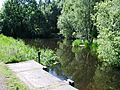
In the 1980s, the canal was stocked with many types of fish, including Carp, Roach, Bream, Tench, and Perch. Scottish Canals and North Lanarkshire council help maintain the waterway, and you don't need a permit to fish there today.
| Point | Coordinates (Links to map resources) |
OS Grid Ref | Notes |
|---|---|---|---|
| Calderbank Basin | 55°50′28″N 3°58′23″W / 55.841°N 3.973°W | NS765626 | Eastern terminus |
| Start of first culvert | 55°51′04″N 3°59′42″W / 55.851°N 3.995°W | NS752638 | |
| Sheepford basin | 55°51′29″N 4°00′11″W / 55.858°N 4.003°W | NS747645 | |
| Blair Road bridge | 55°51′40″N 4°02′42″W / 55.861°N 4.045°W | NS721649 | |
| Start of second culvert | 55°51′40″N 4°04′26″W / 55.861°N 4.074°W | NS702650 | |
| Junction with M8 motorway | 55°51′36″N 4°06′07″W / 55.860°N 4.102°W | NS685650 | |
| Ruchazie | 55°52′08″N 4°09′25″W / 55.869°N 4.157°W | NS651661 | |
| Riddrie | 55°52′26″N 4°11′02″W / 55.874°N 4.184°W | NS634666 | |
| Blackhill | 55°52′16″N 4°12′00″W / 55.871°N 4.200°W | NS624663 | Locks and inclined plane |
| Townhead Basin | 55°52′19″N 4°14′56″W / 55.872°N 4.249°W | NS593666 |
Images for kids
-

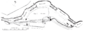
Route of the canal from the one-inch OS maps of 1945-47, shortly before closure
-
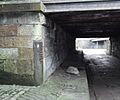
Grooves worn by ropes of canal barges at Townhead on the Cut of Junction, now pedestrian subway under Castle Street at Royston Road
-
Plan of the Blackhill Incline
-

Longitudinal section of the Blackhill incline
-
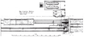
Plan of machinery at the head of the Incline
-
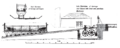
Section of head of the incline


-
North Calder Water dam and source
-
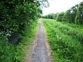
Start of the canal
-
Upper Faskine bridge
-

Faskine basin
-
Lower Faskine bridge
-
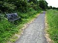
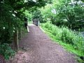
Seat on towpath Tunnels & Bridges
-
Seat on towpath Vulcan
-
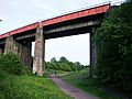
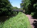
Caledonian Viaduct
-
Road bridge over Sheepford Locks
-
Sheepford Locks artwork
-
Wildlife artwork
-
Canal branch in Summerlee Heritage Park
-
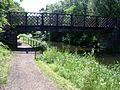
Blair Road bridge
-
King Street from Blair Road bridge
-
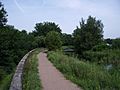
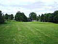
Tow path in Drumpellier Park
-
Burginsholme Burn weir
-
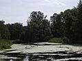
Eastern view in Drumpellier Park
-
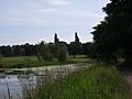
Eastern view in Drumpellier Park
-
West to Drumpellier Home Farm bridge
-
East to Drumpellier Home Farm bridge
-
East from Drumpellier Home Farm bridge
-
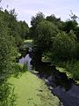
Abandoned Drumpeller Colliery basin
-
Culverted under the North Clyde Line railway
-
West of the North Clyde Line railway
-
Culvert at Cuilhill
-
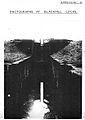
Scan of photograph of Blackhill Locks
-
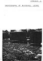
Scan of photograph of Blackhill Locks lower basin


