
World Geodetic System facts for kids
The World Geodetic System (WGS) is like a special, worldwide mapping system for our planet, Earth. It's a standard way to describe locations, heights, and even the shape of the Earth itself. This system is super important for things like making maps (cartography), studying Earth's shape (geodesy), and finding your way around (navigation), especially with your phone's GPS!
It includes a standard way to give coordinates (like latitude and longitude) for any spot on Earth. It also has rules for measuring how high or low places are (altitude). Plus, it uses something called a geoid, which is like a model of what the sea level would look like if it could go all over the Earth, even under continents. The most recent and widely used version of this system is called WGS 84.
Contents
What is the World Geodetic System?
The World Geodetic System, or WGS, is a set of rules and measurements that helps us accurately map the entire Earth. Think of it as a common language that all maps, navigation devices, and satellite systems use to understand where things are. Without a standard like WGS, different maps might show the same place in slightly different spots, which would be very confusing!
Why is WGS important for GPS?
You know how your phone or a car's GPS can tell you exactly where you are? That's because it uses the WGS 84 system! GPS satellites orbiting Earth send signals that your device picks up. These signals contain information about the satellite's position, which is defined using WGS 84. Your device then uses this information to calculate your own position on Earth, also in WGS 84 coordinates. It's how GPS knows your exact location and can guide you.
How does WGS describe Earth's shape?
The Earth isn't a perfect sphere; it's a bit squashed at the poles and bulges at the equator. WGS uses a mathematical model called an ellipsoid to represent this shape. This ellipsoid is a smooth, slightly flattened sphere that helps define the basic grid for latitude and longitude.
Understanding the Geoid
While the ellipsoid gives us a smooth shape, the Earth's surface isn't smooth at all! There are mountains, valleys, and oceans. The geoid is another important part of WGS. It's a bumpy, wavy surface that represents the average sea level if it could extend everywhere, even under land. It's defined by Earth's gravity. The geoid helps us measure accurate heights above or below "sea level" for any point on Earth.
Images for kids
-
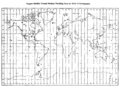
Doppler satellite ground stations providing data for WGS 72 development

