
Image: Montclair old road map

Size of this preview: 565 × 600 pixels. Other resolutions: 226 × 240 pixels | 4,434 × 4,707 pixels.
Original image (4,434 × 4,707 pixels, file size: 6.97 MB, MIME type: image/jpeg)
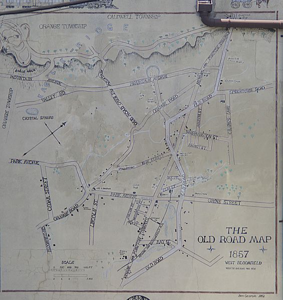
Description: A mural of the map of Montclair, New Jersey as of 1857, when it was known as West Bloomfield.
Title: Montclair old road map
Credit: Own work
Author: Aplaster
Usage Terms: Creative Commons Attribution-Share Alike 3.0
License: CC BY-SA 3.0
License Link: http://creativecommons.org/licenses/by-sa/3.0
Attribution Required?: Yes
Image usage
The following page links to this image:

All content from Kiddle encyclopedia articles (including the article images and facts) can be freely used under Attribution-ShareAlike license, unless stated otherwise.