
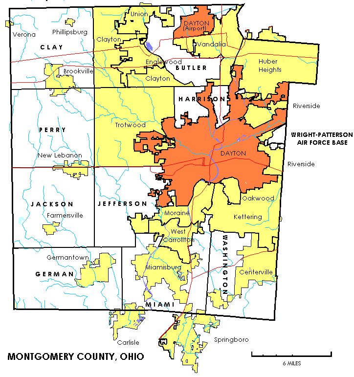
Image: Montgomerytownships
Size of this preview: 563 × 600 pixels. Other resolutions: 225 × 240 pixels | 724 × 771 pixels.
Original image (724 × 771 pixels, file size: 57 KB, MIME type: image/png)
Description: The image depicts the administrative divisions of Montgomery County, Ohio; cities, villages, CDPs, and townships
Title: Montgomerytownships
Credit: Self-created from US Federal Census maps and data.
Author: United States Census Bureau
Usage Terms: Public domain
License: Public domain
Attribution Required?: No
Image usage
The following page links to this image:

All content from Kiddle encyclopedia articles (including the article images and facts) can be freely used under Attribution-ShareAlike license, unless stated otherwise.