
Image: MontresorChaudiereMap1760

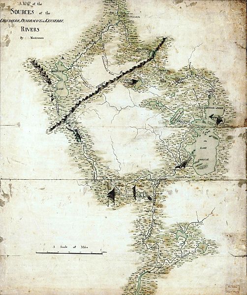
Description: This is an image of a map prepared by British military engineer John Montresor, circa 1760, showing the headwaters of the Penobscot River, Kennebec River, which empty into the Gulf of Maine, and the en:Chaudière River, which empties into the Saint Lawrence River. Benedict Arnold used this map as a guide for his expedition to Quebec in 1775.
Title: MontresorChaudiereMap1760
Credit: This map is available from the United States Library of Congress's Geography & Map Division under the digital ID g3730.ar083800. This tag does not indicate the copyright status of the attached work. A normal copyright tag is still required. See Commons:Licensing for more information.
Author: John Montresor
Permission: This work created by the United Kingdom Government is in the public domain. This is because it is one of the following: It is a photograph taken prior to 1 June 1957; or It was published prior to 1972; or It is an artistic work other than a photograph or engraving (e.g. a painting) which was created prior to 1972. HMSO has declared that the expiry of Crown Copyrights applies worldwide (ref: HMSO Email Reply) More information. See also Copyright and Crown copyright artistic works.
Usage Terms: Public domain
License: Public domain
Attribution Required?: No
Image usage
The following page links to this image:
