
Image: Mount Rainier 3
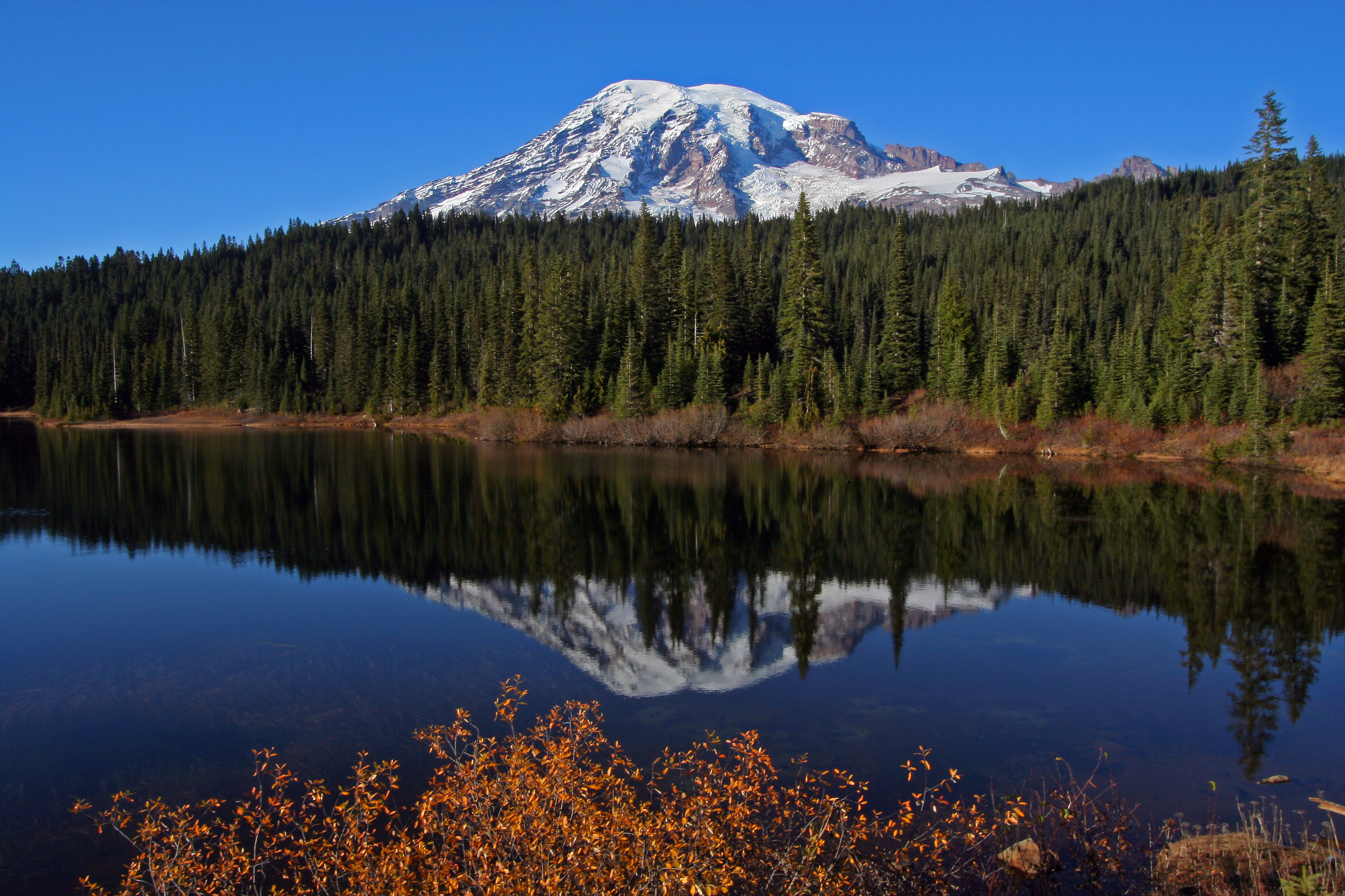
Description: Nothing better than just a simply beautiful view of Mount Rainier from Reflection Lake. Mount Rainier, the highest peak in the Cascade Range at 4,392m (14,410 ft), forms a dramatic backdrop to the Puget Sound region. During an eruption 5,600 years ago the once-higher edifice collapsed to form a large crater open to the northeast much like that at Mount St. Helens after 1980. Ensuing eruptions rebuilt the summit, filling the large collapse crater. Large lahars (volcanic mudflows) from eruptions and from collapses of this massive, heavily glaciated andesitic volcano have reached as far as the Puget Sound lowlands. Since the last ice age, several dozen explosive eruptions spread tephra (ash, pumice) across parts of Washington. The last magmatic eruption was about 1,000 years ago. Extensive hydrothermal alteration of the upper portion of the volcano has contributed to its structural weakness promoting collapse. An active thermal system driven by magma deep under the volcano has melted out a labyrinth of steam caves beneath the summit icecap. Learn more about Mount Rainier at volcanoes.usgs.gov/volcanoes/mount_rainier/ Photo Credit: Alan Cressler (alan_cressler on Flickr)
Title: Mount Rainier 3
Credit: https://www.flickr.com/photos/27784370@N05/14206169806/
Author: U.S. Geological Survey
Usage Terms: Creative Commons Attribution 2.0
License: CC BY 2.0
License Link: https://creativecommons.org/licenses/by/2.0
Attribution Required?: Yes
Image usage
The following page links to this image:
