
Image: Mount Umunhum aerial view, 2011

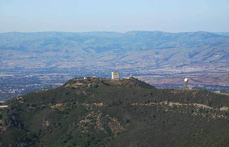
Description: Mt Umunhum - one of the highest peaks in the coastal range overlooking San Jose and Silicon Valley. It used to be an early-warning radar site (the 5 story building on the peak)which was closed in 1980, so the land is now officially part of the Sierra Azul open space preserve. But it is not (yet) publically accessible pending clean-up of asbestos, lead, and black mold. But one day, it will be open for hikers again. This is the view seen by an aviator coming in from the coast towards the Bay Area, cresting the Santa Cruz mountains with San Jose just beyond. In winter there may be a dusting of snow around the peak.
Title: Mount Umunhum aerial view, 2011
Credit: Sentinel over Silicon Valley
Author: Jitze Couperus from Los Altos Hills, California, USA
Usage Terms: Creative Commons Attribution 2.0
License: CC BY 2.0
License Link: https://creativecommons.org/licenses/by/2.0
Attribution Required?: Yes
Image usage
The following page links to this image:
