
Image: Muhammad al-Idrisi - Saint Petersburg transcript of VI-5
Size of this preview: 800 × 555 pixels. Other resolutions: 320 × 222 pixels | 2,108 × 1,462 pixels.
Original image (2,108 × 1,462 pixels, file size: 1.96 MB, MIME type: image/jpeg)
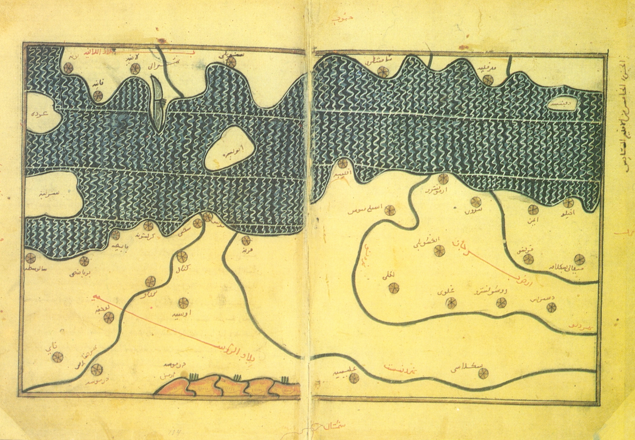
Description: Muhammad al-Idrisi. Saint Petersburg transcript of VI-5. The map displays: part of Bulgarian Black Sea coastline from about Burgas Bay to Danube River, Dobrudzha region. To the east are shown parts of the European territory of Russia: regions around river Dniester and Dnieper. To the south are shown big parts of the Anatolia Black Sea coastline and a big part of Black Sea.
Title: Muhammad al-Idrisi - Saint Petersburg transcript of VI-5
Credit: Scanned from book "Балканският полуостров изобразен в картите на Ал-Идриси", Стоянка Кендерова, Боян Бешевлиев, София, 1990
Author: Muhammad al-Idrisi (1100 – 1165 or 1166)
Usage Terms: Public domain
License: Public domain
Attribution Required?: No
Image usage
The following page links to this image:

All content from Kiddle encyclopedia articles (including the article images and facts) can be freely used under Attribution-ShareAlike license, unless stated otherwise.