
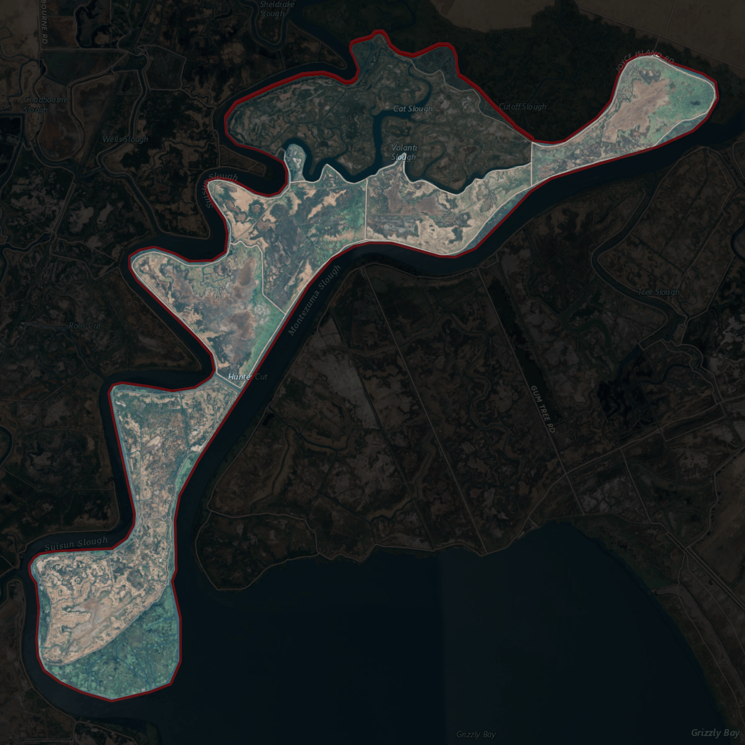
Image: NASA Worldwind, USGS imagery map, Joice Island, California
Description: USGS aerial imagery of w:Joice Island, administered by Reclamation District 2141; proposed addition to RD2141 partially shaded at top. Background is black at 85-90% opacity, outline is 5px border pure red at 20% opacity. Boundaries taken from USGS survey maps (1913 through 2018), reclamation district documents, and county files.
Title: NASA Worldwind, USGS imagery map, Joice Island, California
Credit: NASA tool at worldwind.earth, USGS Topo Imagery map layer
Author: USGS, self
Permission: This image is in the public domain in the United States because it only contains materials that originally came from the United States Geological Survey, an agency of the United States Department of the Interior. For more information, see the official USGS copyright policy.
Usage Terms: Public domain
License: Public domain
Attribution Required?: No
Image usage
The following page links to this image:
