
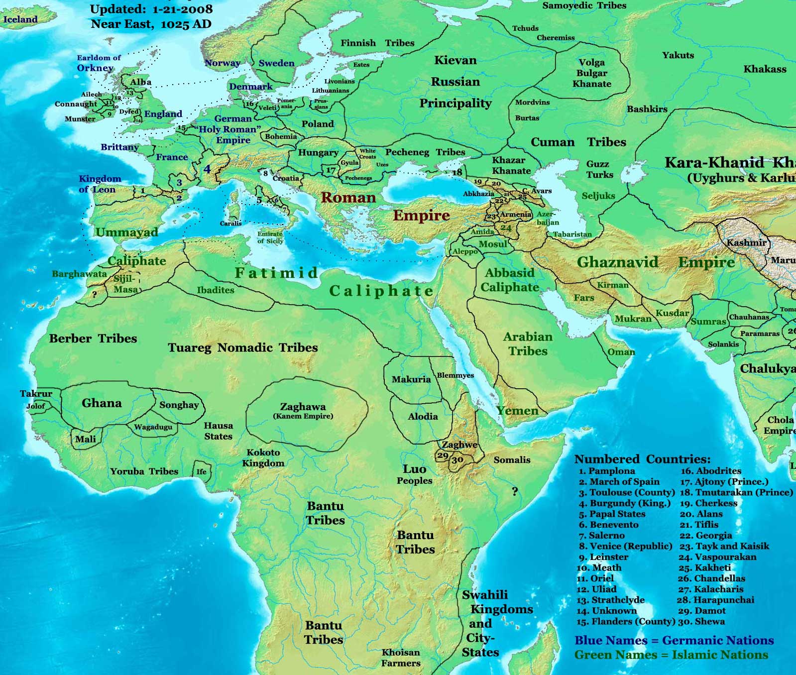
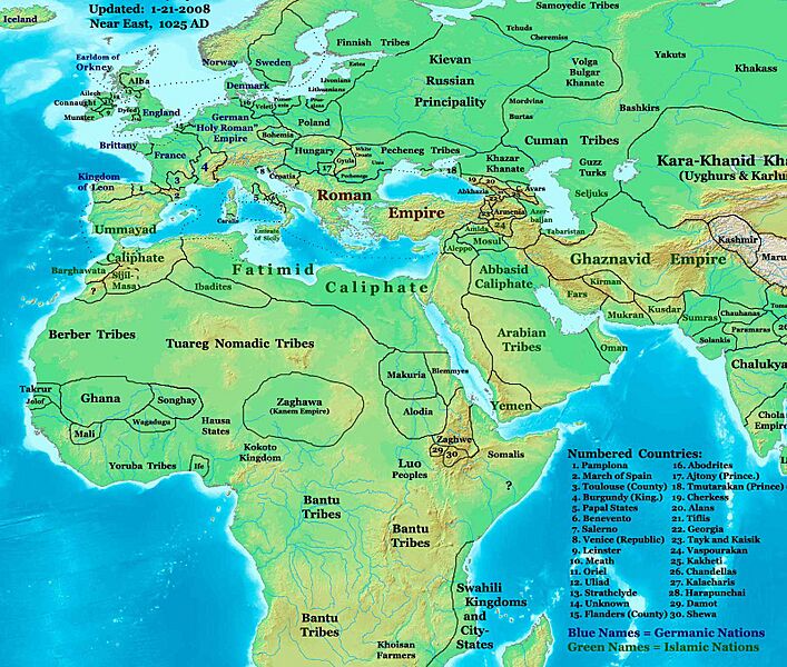
Image: NE 1025ad
Description: This image is a zoomed-in version of Eastern Hemisphere in 1025 AD. Author: Thomas A. Lessman. Source URL: http://www.ThomasLessman.com/History/images/East-Hem_1025ad.jpg. Image was created by me (Thomas Lessman) based on map of Eastern Hemisphere in 1025 AD. Image is free for public and/or educational use. I would appreciate a mention if this image is used elsewhere. If anyone is interested in helping further this work, please contact Thomas Lessman at talessman@yis.us. Other Historical Maps by Thomas Lessman 1.[1]. 2.[2]. 3.[3]. 4. 100 BC. 5.[4]. 6.[5]. 7.[6]. 8.[7]. 9.[8]. 10.[9]. 11.[10]. 12.[11]. 13.[12]. 14.[13]. 15.[14]. 16.[15]. 17.[16]. 18.[17]. 19.[18]. 20.[19]. 21.[20]. 22.[21]. 23.[22].
Title: NE 1025ad
Credit: Transferred from en.wikipedia by SreeBot
Author: Talessman at en.wikipedia
Usage Terms: Creative Commons Attribution 3.0
License: CC BY 3.0
License Link: https://creativecommons.org/licenses/by/3.0
Attribution Required?: Yes
Image usage
The following page links to this image:
