
Image: NYCS Maps IRT 1904
Size of this preview: 800 × 336 pixels. Other resolutions: 320 × 134 pixels | 3,042 × 1,277 pixels.
Original image (3,042 × 1,277 pixels, file size: 1.06 MB, MIME type: image/jpeg)
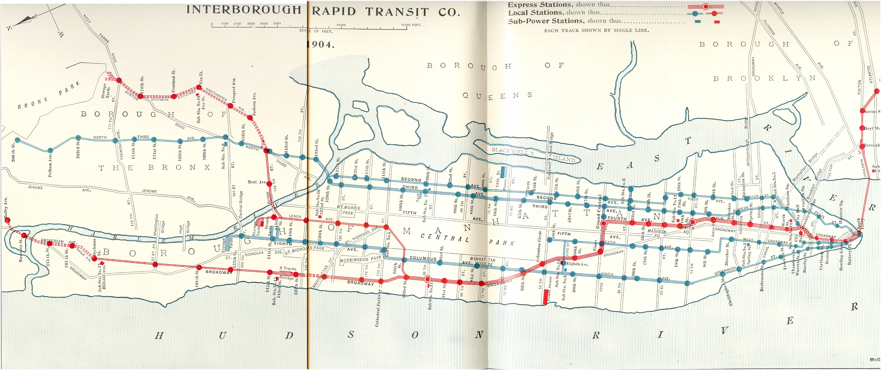
Description: Line map of the Interborough Rapid Tansit Company after the Contracts No. 1 and No. 2 were signed. The elevated lines are shown blue, the new subway lines are shown red.
Title: NYCS Maps IRT 1904
Credit: The New York Subway — Its Construction and Equipment nycsubway.org
Author: Interborough Rapid Transit Company
Permission: PD-US, PD-Old
Usage Terms: Public domain
License: Public domain
Attribution Required?: No
Image usage
The following page links to this image:

All content from Kiddle encyclopedia articles (including the article images and facts) can be freely used under Attribution-ShareAlike license, unless stated otherwise.