
Image: NZ-NorthShoreCity labels added to map
No higher resolution available.
NZ-NorthShoreCity_labels_added_to_map.png (504 × 600 pixels, file size: 145 KB, MIME type: image/png)
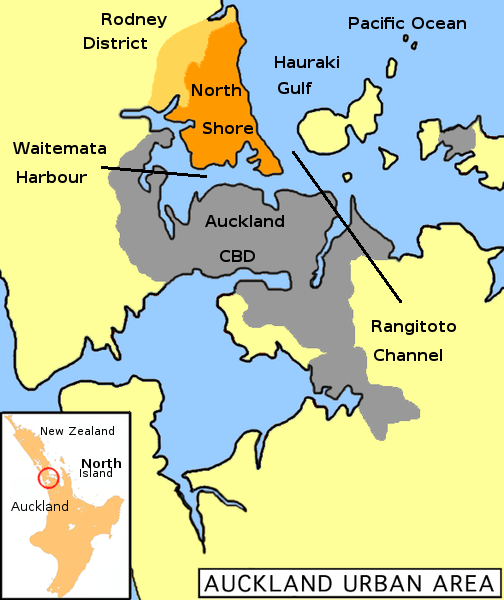
Description: Uploaded from the English Wikipedia, uploaded there by user:Grutness Map of Auckland urban area, North Shore City highlighted (dark orange=populated; light orange=rural areas)
Title: NZ-NorthShoreCity labels added to map
Credit: NZ-NorthShoreCity.png
Author: Thomas Wright Sulcer NZ-NorthShoreCity.png derivative work: Tomwsulcer (talk) 11:46, 30 August 2009 (UTC)Tomwsulcer
Usage Terms: Public domain
License: Public domain
Attribution Required?: No
Image usage
The following page links to this image:

All content from Kiddle encyclopedia articles (including the article images and facts) can be freely used under Attribution-ShareAlike license, unless stated otherwise.