
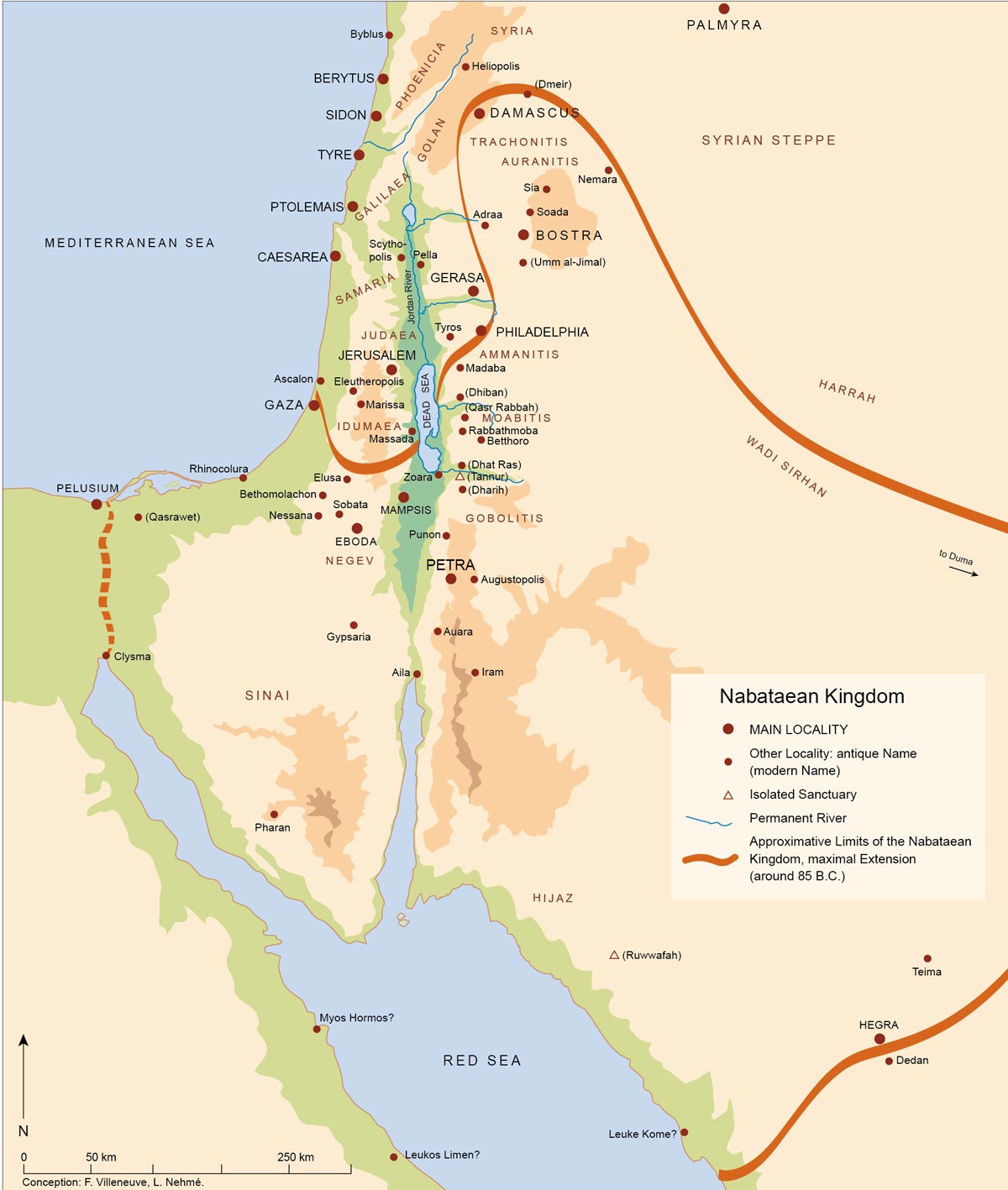
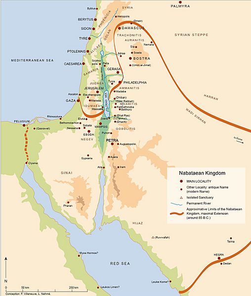
Image: Nabatean Kingdom map
Size of this preview: 508 × 600 pixels. Other resolutions: 203 × 240 pixels | 1,200 × 1,417 pixels.
Original image (1,200 × 1,417 pixels, file size: 152 KB, MIME type: image/jpeg)
Description: This is the map of the Nabatean Kingdom
Title: Nabatean Kingdom map
Credit: http://books.openedition.org/ifpo/docannexe/image/4896/img-1-small700.jpg
Author: http://books.openedition.org/ifpo/4896?lang=en
Usage Terms: Creative Commons Attribution-Share Alike 4.0
License: CC BY-SA 4.0
License Link: https://creativecommons.org/licenses/by-sa/4.0
Attribution Required?: Yes
Image usage
The following page links to this image:

All content from Kiddle encyclopedia articles (including the article images and facts) can be freely used under Attribution-ShareAlike license, unless stated otherwise.