
Image: Natlparks and RRs 1916
Size of this preview: 800 × 568 pixels. Other resolutions: 320 × 227 pixels | 1,623 × 1,153 pixels.
Original image (1,623 × 1,153 pixels, file size: 1.18 MB, MIME type: image/jpeg)
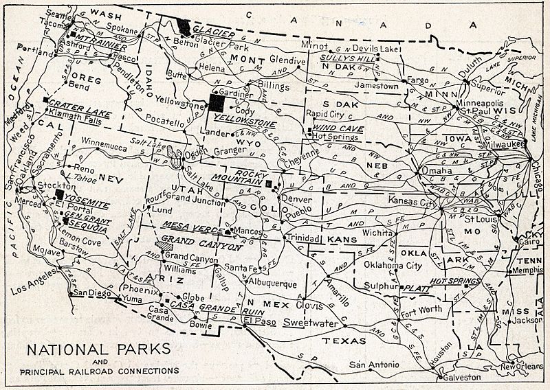
Description: The map shows the location of all the National Parks and their principal railroad connections as of 1916.
Title: Natlparks and RRs 1916
Credit: National Parks Portfolio, 1916
Author: Department of the Interior, Franklin K. Lane, Secretary
Permission: This image is a work of the United States Department of the Interior, taken or made as part of that person's official duties. As a work of the U.S. federal government, the image is in the public domain.
Usage Terms: Public domain
License: Public domain
Attribution Required?: No
Image usage
The following page links to this image:

All content from Kiddle encyclopedia articles (including the article images and facts) can be freely used under Attribution-ShareAlike license, unless stated otherwise.