
Image: Navigation Technology Satellite – II
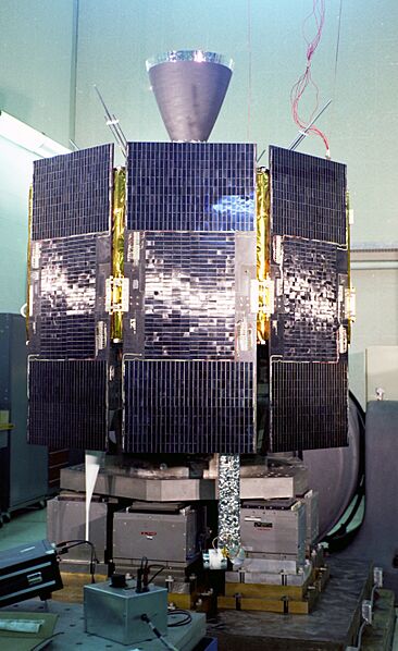


Description: Navigation Technology Satellite – II (Timation IV): NTS-II, the first satellite completely designed and built by NRL under GPS Joint Program funding. It was the first of a four-satellite constellation configured to demonstrate instantaneous navigation positioning. NTS-II was the first operational NAVSTAR GPS Satellite. Launch Date: June 23, 1977. (U.S. Navy photo; 78375; c. 1977) The effect of relativity on the onboard cesium atomic clocks was measured and
corrected so that a GPS receiver on Earth could observe that the rate of GPS time is the same as UTC (Universal Time Coordinated). The clock frequency stability specification of 2 parts per 1013 was met. NTS-II was the first operational NAVSTAR GPS Satellite. Launch Date:June 23, 1977. (78375)
Usage Terms: Public domain
Image usage
The following page links to this image:

