
Image: Nearctic-Neotropic map
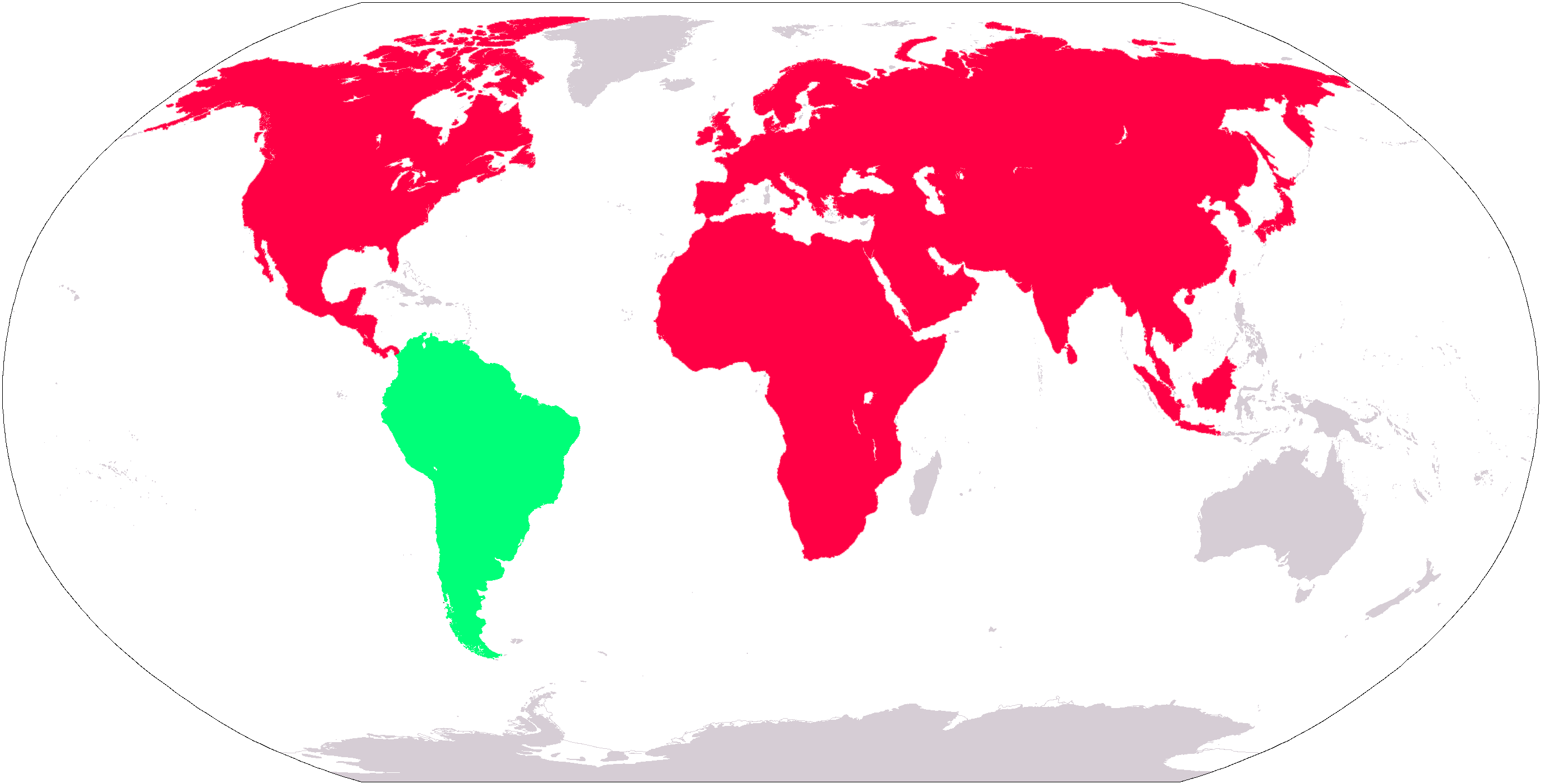
Description: Map shows land areas over which ancestors of Neotropic (green) and Nearctic (red) species were able to wander via two-way migrations during the latter part of the Cenozoic Era (prior to the Great American Interchange).
Title: Nearctic-Neotropic map
Credit: PDF world map at CIA World Fact Book via File:LocationSouthAmerica.png
Author: Central Intelligence Agency, Maximaximax, Ghalas, Huhsunqu, E Pluribus Anthony, Cogito ergo sumo, and Snoopen82 (via Image:LocationSouthAmerica2.png per Commons:Administrators' noticeboard/Attention#Move_image_request_Image:LocationSouthAmerica2.png_to_Image:LocationSouthAmerica.png_.28user_account_too_new.29) and further modified by User:WolfmanSF
Permission: This image is in the public domain because it contains materials that originally came from the United States Central Intelligence Agency's World Factbook.
Usage Terms: Public domain
License: Public domain
Attribution Required?: No
Image usage
The following page links to this image:
