
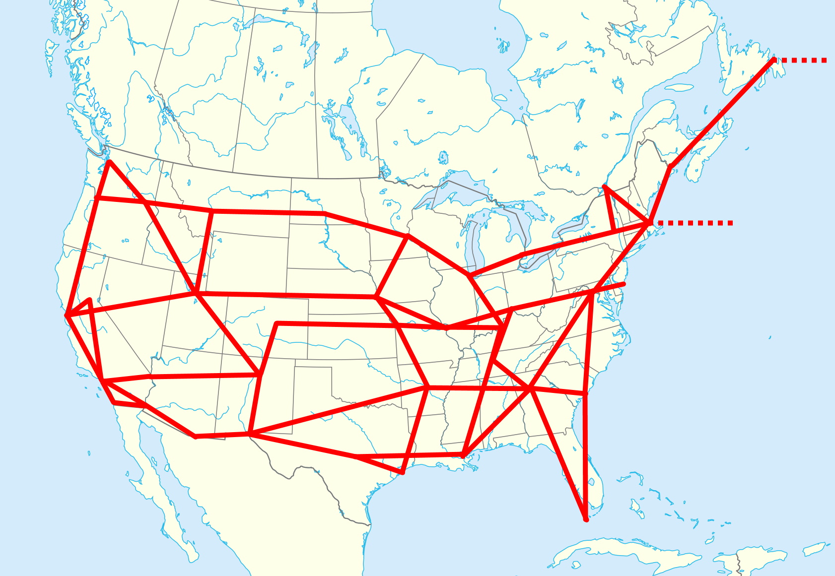
Image: Net of Longitude
Description: The Net of Longitude, USA and NE Canada 1896. Each line segment shows a determination of longitude difference between two locations. Dotted lines indicate transatlantic cable connections to Europe. Base map is File:North America map with states and provinces.svg. Longitude data from Table presented in Schott, Charles A. (1897). "The telegraphic longitude net of the United States and its connection with that of Europe, as developed by the Coast and Geodetic Survey between 1866 and 1896". The Astronomical Journal 18: 25-28.
Title: Net of Longitude
Credit: Own work
Author: Kognos
Usage Terms: Creative Commons Attribution-Share Alike 4.0
License: CC BY-SA 4.0
License Link: https://creativecommons.org/licenses/by-sa/4.0
Attribution Required?: Yes
Image usage
The following page links to this image:
