
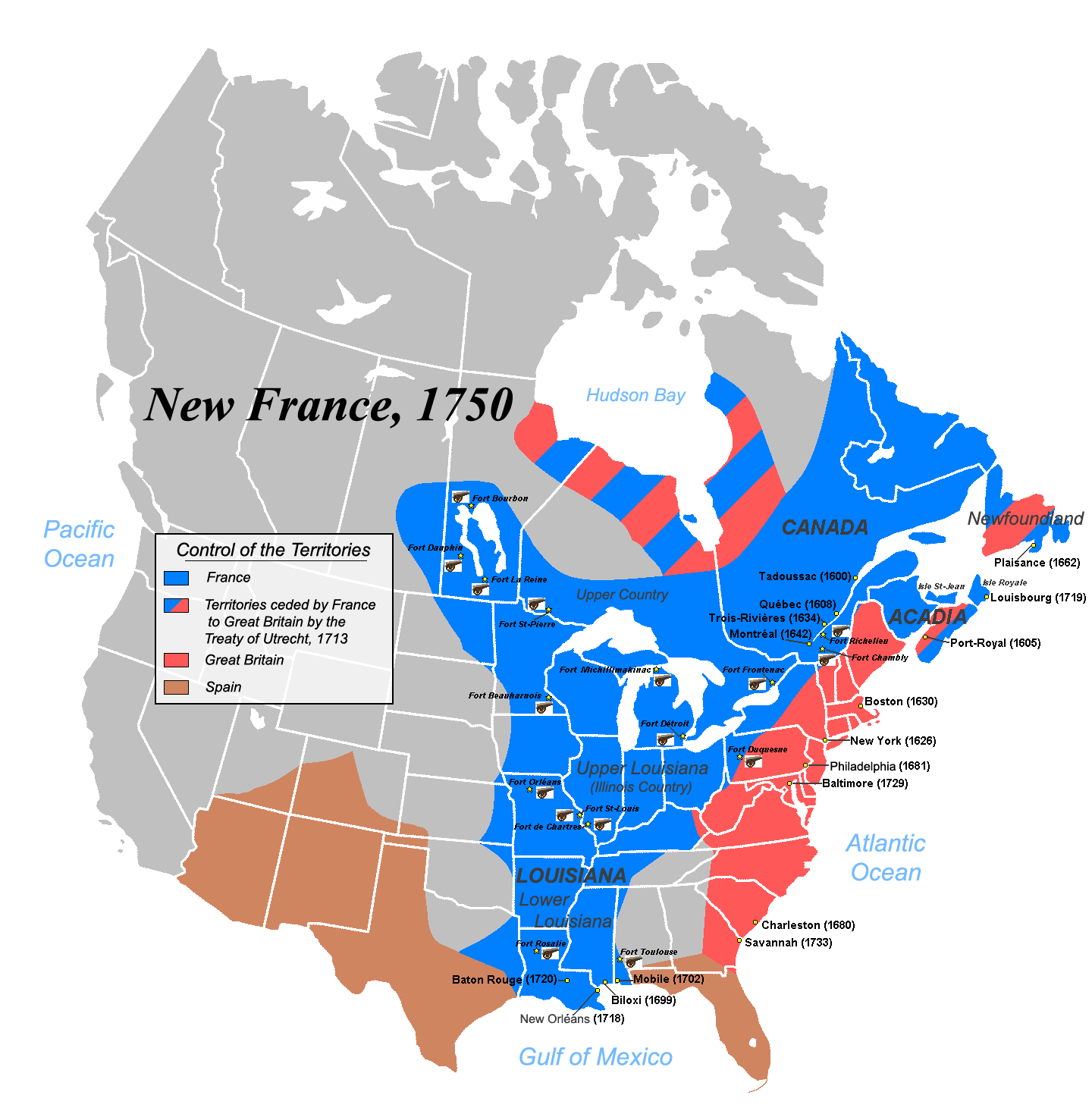
Image: New-France1750
Size of this preview: 589 × 599 pixels. Other resolutions: 236 × 240 pixels | 1,440 × 1,465 pixels.
Original image (1,440 × 1,465 pixels, file size: 68 KB, MIME type: image/png)
Description: Map of the New-France about 1750.
Title: New-France1750
Credit: 1)Les Villes françaises du Nouveau Monde : des premiers fondateurs aux ingénieurs du roi, XVIe-XVIIIe siècles / sous la direction de Laurent Vidal et Emilie d'Orgeix /Éditeur: Paris: Somogy 1999. 2) Canada-Québec 1534-2000/ Jacques Lacoursière, Jean Provencher et Denis Vaugeois/Éditeur: Sillery (Québec): Septentrion 2000.
Author: JF Lepage
Usage Terms: Creative Commons Attribution-Share Alike 3.0
License: CC-BY-SA-3.0
License Link: http://creativecommons.org/licenses/by-sa/3.0/
Attribution Required?: Yes
Image usage
The following page links to this image:

All content from Kiddle encyclopedia articles (including the article images and facts) can be freely used under Attribution-ShareAlike license, unless stated otherwise.