
Image: Niagara-boundary-1819

Size of this preview: 800 × 525 pixels. Other resolutions: 320 × 210 pixels | 1,038 × 681 pixels.
Original image (1,038 × 681 pixels, file size: 380 KB, MIME type: image/jpeg)
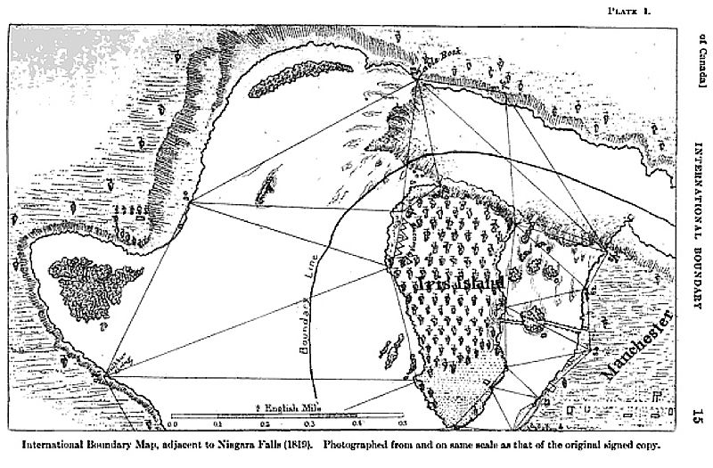
Description: 1819 map of the International Boundary Line at Niagara Falls, based on the work of the Boundary Commission of 1819. Drawn by Commissioners Peter B. Porter and Anth. Barclay, and surveyors William A. Bird and David Thompson, based on boundary rules established under the Treaty of Ghent. Map is oriented so north points to right edge of map. American side includes Iris Island (now Goat Island) and town labeled Manchester (now Niagara Falls, New York).
Title: Niagara-boundary-1819
Credit: U.S. State Department
Author: Peter B. Porter, Anth. Barclay, William A. Bird, and David Thompson
Usage Terms: Public domain
License: Public domain
Attribution Required?: No
Image usage
The following 2 pages link to this image:

All content from Kiddle encyclopedia articles (including the article images and facts) can be freely used under Attribution-ShareAlike license, unless stated otherwise.