Horseshoe Falls facts for kids
Quick facts for kids Horseshoe Falls |
|
|---|---|
| Canadian Falls | |
 |
|
| Lua error in Module:Infobox_mapframe at line 185: attempt to index field 'wikibase' (a nil value). | |
| Location | Border of Ontario, Canada, and New York, United States. Canada to the right in the photo. |
| Coordinates | 43°04′38″N 79°04′32″W / 43.077305°N 79.07562°W |
| Type | Cataract |
| Total height | 167 ft (51 m) |
| Total width | 2,700 ft (820 m) |
| Watercourse | Niagara River |
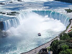
Horseshoe Falls, also called Canadian Falls, is the biggest waterfall in Niagara Falls. It's one of three amazing waterfalls found on the Niagara River. This river forms part of the border between Canada and the United States.
About 90% of the Niagara River's water flows over Horseshoe Falls. The rest of the water goes over the American Falls and Bridal Veil Falls. Some water is also used to make electricity.
Horseshoe Falls is located between Terrapin Point on Goat Island in New York (USA) and Table Rock in Ontario (Canada).
The International Border at the Falls
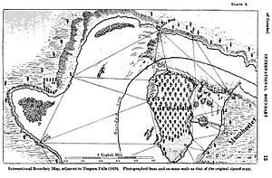
The border between the United States and Canada was decided in 1819. This was based on an agreement called the Treaty of Ghent. At that time, a small part of Horseshoe Falls was in New York, USA. This part flowed around some rocks called Terrapin Rocks. These rocks used to be connected to Goat Island by bridges.
In 1955, the area between the rocks and Goat Island was filled in. This created a spot called Terrapin Point. Later, in the early 1980s, the United States Army Corps of Engineers added more land. They also built walls to guide the water away from Terrapin Point. Because of these changes, about 400 feet (120 meters) of Horseshoe Falls was removed.
The falls are always changing because of erosion. This means the border line across the falls will also keep moving over time. Official maps from both Canada and the United States show that a small part of Horseshoe Falls is still in the United States.
Gallery
-
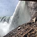
Horseshoe Falls, seen from Table Rock Centre in Niagara Falls, Ontario.
See also
 In Spanish: Horseshoe Falls para niños
 | Shirley Ann Jackson |
 | Garett Morgan |
 | J. Ernest Wilkins Jr. |
 | Elijah McCoy |


