
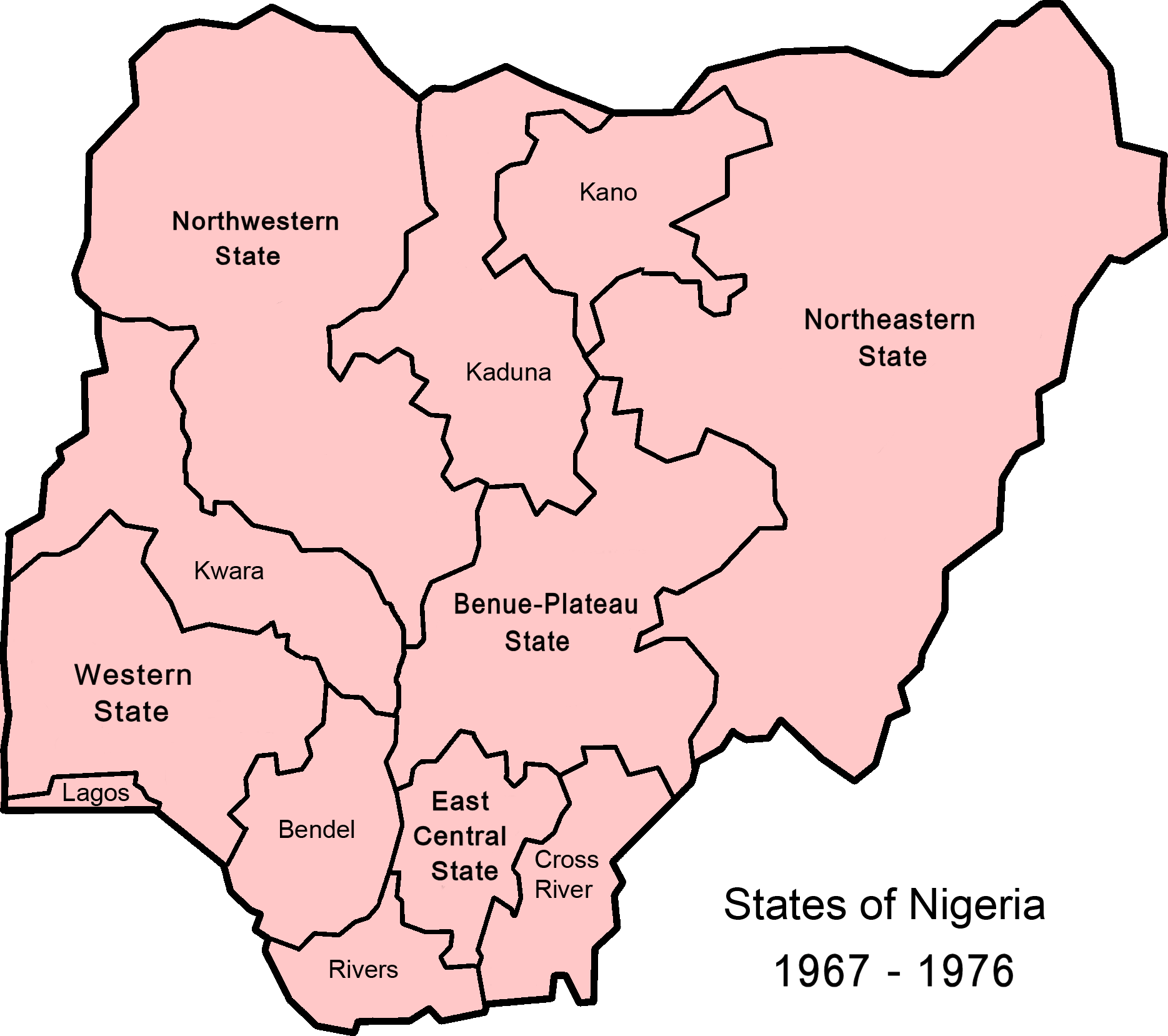
Image: Nigeria states-1967-1976
Size of this preview: 676 × 600 pixels. Other resolutions: 271 × 240 pixels | 1,869 × 1,658 pixels.
Original image (1,869 × 1,658 pixels, file size: 62 KB, MIME type: image/png)
Description: Map of Nigerian states, 1967 - 1976, from data from United States Geological Survey, Africa Data Dissemination Service.
Title: Nigeria states-1967-1976
Credit: Nigeria_states-1976-1987.png
Author: Nigeria_states-1976-1987.png: *Nigeria_states_1987-1991.png: self derivative work: Bejnar (talk) derivative work: Bejnar (talk)
Usage Terms: Creative Commons Attribution-Share Alike 3.0
License: CC BY-SA 3.0
License Link: http://creativecommons.org/licenses/by-sa/3.0/
Attribution Required?: Yes
Image usage
The following page links to this image:

All content from Kiddle encyclopedia articles (including the article images and facts) can be freely used under Attribution-ShareAlike license, unless stated otherwise.