
Image: Noel Park locator

Size of this PNG preview of this SVG file: 519 × 308 pixels. Other resolution: 320 × 190 pixels.
Original image (SVG file, nominally 519 × 308 pixels, file size: 53 KB)
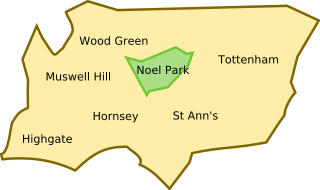
Description: The boundary of the ward, Noel Park, shown within the boundary of the burrough of Haringey, London.
Title: Noel Park locator
Credit: Personal creation: general outlines of Haringey and Noel Park based on the maps of: Benefit Fraud Inspectorate Boundary Comission for England
Author: Jappalang
Usage Terms: Public domain
License: Public domain
Attribution Required?: No
Image usage
The following page links to this image:

All content from Kiddle encyclopedia articles (including the article images and facts) can be freely used under Attribution-ShareAlike license, unless stated otherwise.