
Image: North Sea Mine Barrage map 1918

Size of this preview: 490 × 599 pixels. Other resolutions: 196 × 240 pixels | 902 × 1,103 pixels.
Original image (902 × 1,103 pixels, file size: 213 KB, MIME type: image/png)
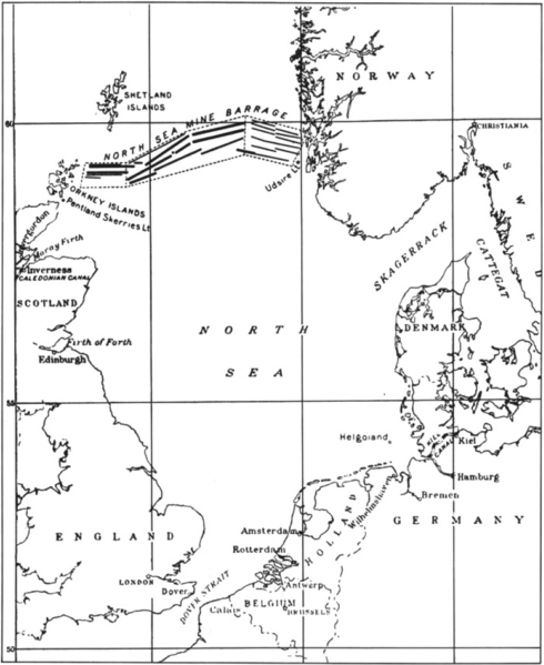
Description: Map of the North Sea Mine Barrage, laid in the Summer of 1918. The mine barrage consisted of 18 rows of mines laid in an east-west direction between the Orkneys and Norway. The minefield was laid by British and U.S. ships. 56,571 of the 70,177 mines were deployed by the U.S. Navy.
Title: North Sea Mine Barrage map 1918
Credit: U.S. Navy All Hands magazine April 1986, p. 20.
Author: U.S. Navy
Usage Terms: Public domain
License: Public domain
Attribution Required?: No
Image usage
The following page links to this image:

All content from Kiddle encyclopedia articles (including the article images and facts) can be freely used under Attribution-ShareAlike license, unless stated otherwise.