
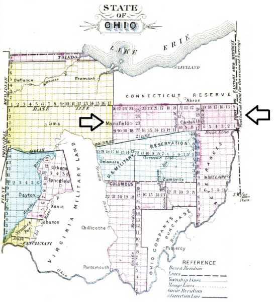
Image: North of Old Seven Ranges

Size of this preview: 553 × 599 pixels. Other resolutions: 221 × 240 pixels | 764 × 828 pixels.
Original image (764 × 828 pixels, file size: 314 KB, MIME type: image/png)
Description: map of lands in northeast Ohio called Congress Land North of Old Seven Ranges surveyed early in 19th century
Title: North of Old Seven Ranges
Credit: Higgins, Jerome S. (1887) Subdivisions of the Public Lands, Described and Illustrated, with Diagrams and Maps, Higgins & Co., p. 93
Author: Jerome S. Higgins
Usage Terms: Public domain
License: Public domain
Attribution Required?: No
Image usage
The following page links to this image:

All content from Kiddle encyclopedia articles (including the article images and facts) can be freely used under Attribution-ShareAlike license, unless stated otherwise.