
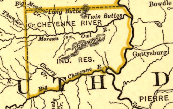
Image: Northern Pacific Railway map circa 1900 Cheyenne River Indian Reservation
No higher resolution available.
Northern_Pacific_Railway_map_circa_1900_Cheyenne_River_Indian_Reservation.png (577 × 366 pixels, file size: 167 KB, MIME type: image/png)
Description: Derivative of Northern Pacific Railroad map circa 1900.jpg showing the Cheyenne River Indian Reservation in South Dakota
Title: Northern Pacific Railway map circa 1900 Cheyenne River Indian Reservation
Credit: Derivative of File:Northern Pacific Railroad map circa 1900.jpg
Author: Map created by L.L. Poates Engr'g Co., New York, 1900.
Usage Terms: Public domain
License: Public domain
Attribution Required?: No
Image usage
The following page links to this image:

All content from Kiddle encyclopedia articles (including the article images and facts) can be freely used under Attribution-ShareAlike license, unless stated otherwise.