
Image: Numbat historical map

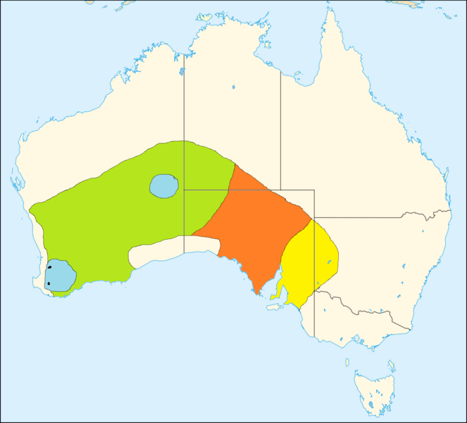
Description: Historical range map of the numbat (Myrmecobius fasciatus) yellow: became extinct between 1800 and 1910 orange: became extinct between 1910 and 1930 green: became extinct between 1930 and 1960 blue: became extinct between 1960 and 1980 black: remaining range in 1980 map based on: L. Fumagalli, C. Moritz, P. Taberlet & J. A. Friend: Mitochondrial DNA sequence variation within the remnant populations of the endangered numbat (Marsupialia: Myrmecobiidae: Myrmecobius fasciatus). In: Molecular Ecology 1999, no. 8, p. 1545-1549
Title: Numbat historical map
Credit: This file was derived from: AUS locator map.svg:
Author: AUS_locator_map.svg: Yarl Talk • PL derivative work: Baldhur (talk)
Usage Terms: Creative Commons Attribution-Share Alike 3.0
License: CC-BY-SA-3.0
License Link: http://creativecommons.org/licenses/by-sa/3.0/
Attribution Required?: Yes
Image usage
The following page links to this image:
