
Image: Old New AL20 (19911376149)
Size of this preview: 400 × 600 pixels. Other resolutions: 160 × 240 pixels | 800 × 1,200 pixels.
Original image (800 × 1,200 pixels, file size: 328 KB, MIME type: image/jpeg)
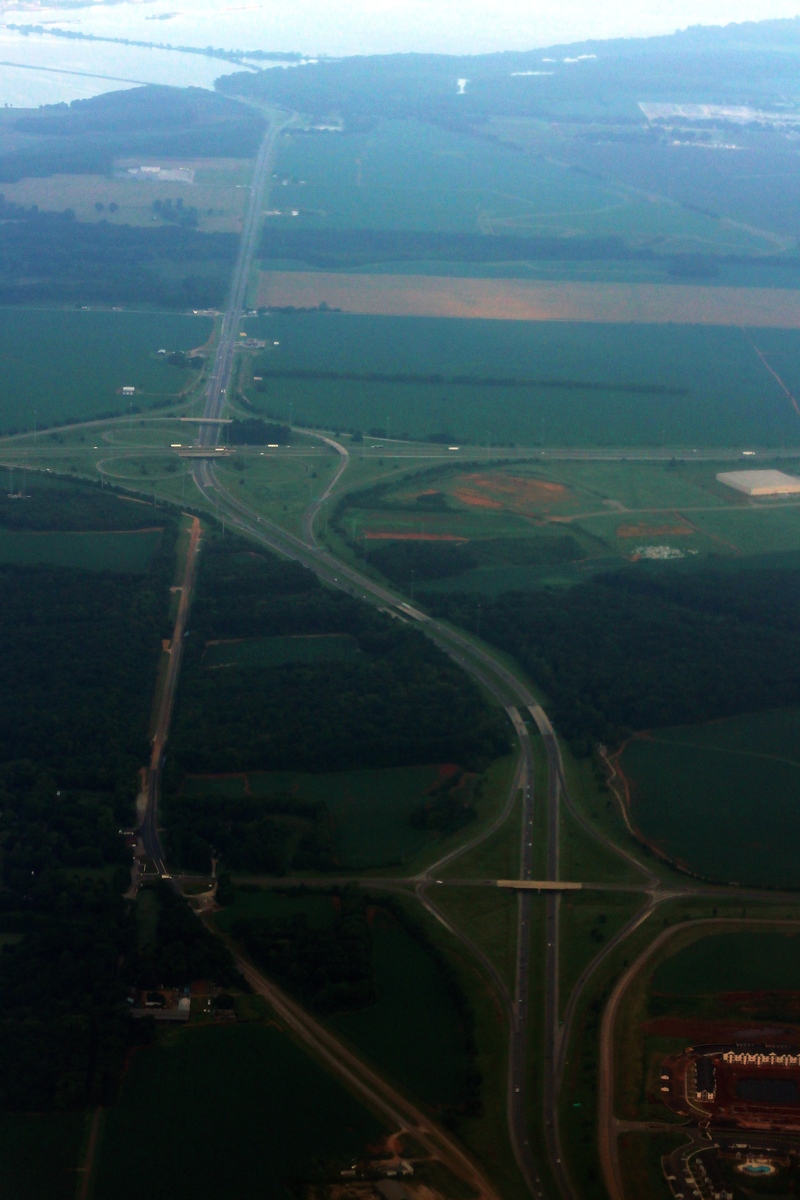
Description: The former routing of Alabama State Route 20 to the left, and current Interstate 565 is to the right. I suppose the bypass of AL 20 was to prevent destroying the small town of Mooresville. You can see how they lined up to cross the Tennessee River. Old New AL20 (19911376149).jpg
Title: Old New AL20 (19911376149)
Credit: Old / New AL20
Author: formulanone
Usage Terms: Creative Commons Attribution-Share Alike 2.0
License: CC BY-SA 2.0
License Link: https://creativecommons.org/licenses/by-sa/2.0
Attribution Required?: Yes
Image usage
The following page links to this image:

All content from Kiddle encyclopedia articles (including the article images and facts) can be freely used under Attribution-ShareAlike license, unless stated otherwise.
.jpg)