
Image: Ontario Highway 62 - 1937-38
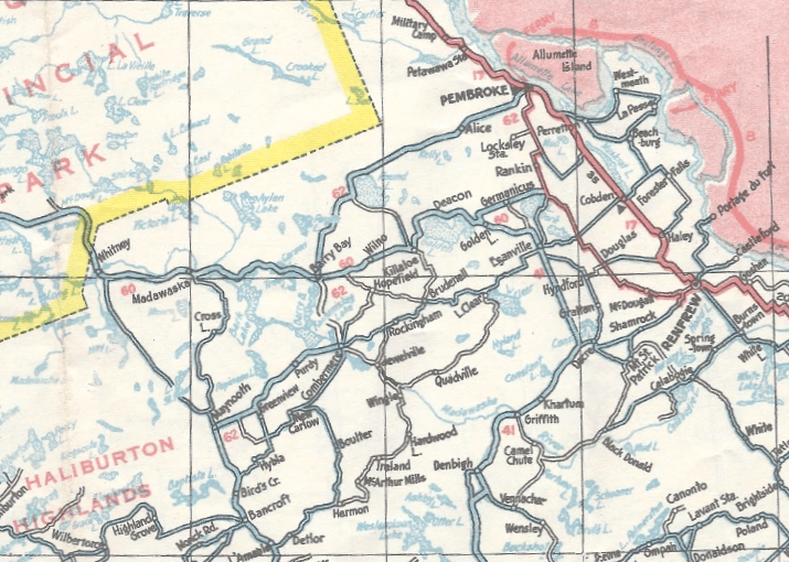
Description: 1937–38 map of Ontario, showing towns and numbered highways northwest of Ottawa. Of note is the section of Ontario Highway 62 between Barry's Bay and Round Lake, which was never built.
Title: Ontario Highway 62 - 1937-38
Credit: Ontario Road Map, 1937–38 edition. Cartography by D. Barclay. Available at Eric's Licence Plates.
Author: Ontario Department of Highways (Ministry of Transportation of Ontario)
Permission: This Canadian work is in the public domain worldwide because it was subject to Crown copyright and was created before December 31, 1970. According to Public Works and Government Services Canada / Travaux publics et Services gouvernementaux Canada, Canada has no intention of renewing expired Crown Copyright works in any country, and consequently the URAA does not apply. An email is on record at OTRS ticket # 2013122310013986. PD Public domain false false
Usage Terms: Public domain
License: PD
Attribution Required?: No
Image usage
The following page links to this image:
