
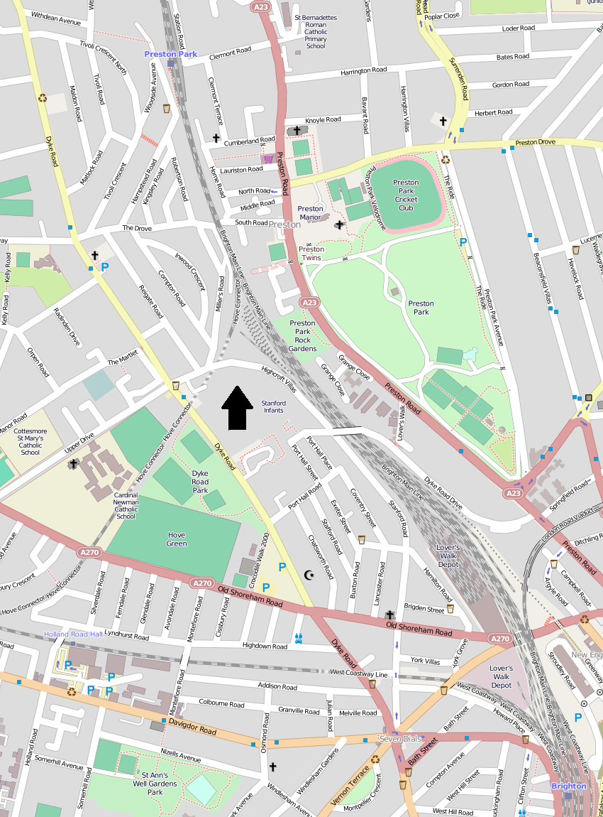
Image: OpenStreetMap of Prestonville, Brighton
Size of this preview: 443 × 599 pixels. Other resolutions: 177 × 240 pixels | 850 × 1,150 pixels.
Original image (850 × 1,150 pixels, file size: 704 KB, MIME type: image/png)
Description: A map of the Prestonville area of Brighton, part of the English city of Brighton and Hove. The boundaries are Dyke Road, Tivoli Crescent North, Preston Park station, the London–Brighton railway line, Old Shoreham Road and Seven Dials. Derived from OpenStreetMap (permalink). North is indicated by the large arrow.
Title: OpenStreetMap of Prestonville, Brighton
Credit: OpenStreetMap
Author: Hassocks5489
Usage Terms: Creative Commons Attribution-Share Alike 2.0
License: CC BY-SA 2.0
License Link: http://creativecommons.org/licenses/by-sa/2.0
Attribution Required?: Yes
Image usage
The following page links to this image:

All content from Kiddle encyclopedia articles (including the article images and facts) can be freely used under Attribution-ShareAlike license, unless stated otherwise.