
Image: Orbis typus uniuersalis iuxta hydrographorum traditionem - Norman B. Leventhal Map Center at the BPL

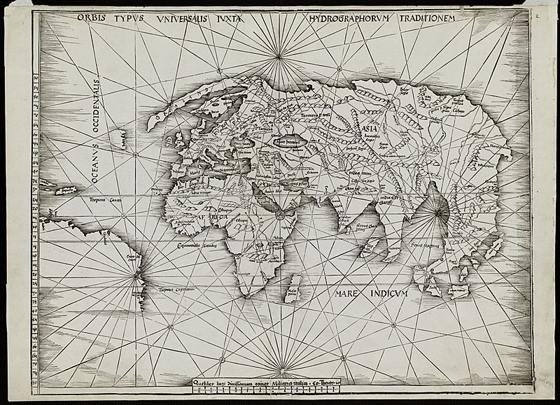
Description: Zoom into this map at maps.bpl.org. Author: Waldseemèuller, Martin Publisher: Johannes Schott Date: 1513. Location: America Scale: Scale not given. Call Number: G3200 1513.W3 Waldseemèuller may have had second thoughts about his 1507 proposal for naming the new continent "America." In 1513, he issued a fourth publication, a new edition of Claudius Ptolemy's Geographia. In it he included contemporary world and regional maps as well as the traditional 27 found in the first printed versions of the Geographia. Surprisingly, his "modern world map" is not a reduced version of his original 1507 map of the world. Waldseemueller's 1513 map, often referred to as the "Admiral's Map," reportedly reflects Columbus's interpretation of the New World discoveries. Consequently, the map focuses on the Caribbean islands and northern South America, which is placed at the map's western margins with no indication of a western coastline. The name "America" is excluded in this updated world map. Substantiating this retraction is another map in the same volume. On the regional map of the Caribbean and Atlantic Ocean (Tabula Terre Nove), South America is labeled "Terra Incognita" (unknown land) and bears an inscription indicating that these lands were discovered by Columbus, with no indication of Amerigo Vespucci's role in the exploration of the northern coast of South America.
Title: Orbis typus uniuersalis iuxta hydrographorum traditionem - Norman B. Leventhal Map Center at the BPL
Credit: Orbis typus uniuersalis iuxta hydrographorum traditionem
Author: Martin Waldseemüller
Usage Terms: Creative Commons Attribution 2.0
License: CC BY 2.0
License Link: https://creativecommons.org/licenses/by/2.0
Attribution Required?: Yes
Image usage
The following page links to this image:
