
Norman B. Leventhal Map Center facts for kids
The Norman B. Leventhal Map & Education Center is a special place inside the Boston Public Library in Boston, Massachusetts. It's like a treasure chest filled with old and new maps, globes, and other cool geographic stuff. The center helps people learn about history and geography through its amazing collection and special programs.
Quick facts for kids Norman B. Leventhal Map & Education Center |
|
|---|---|

Entrance
|
|
| Housed at | Boston Public Library |
| Curators | Garrett Dash Nelson |
| Website | https://leventhalmap.org |

The center was started in 2004. It received $10 million from a map collector and generous person named Norman B. Leventhal. This made it a team effort between the Boston Public Library and Mr. Leventhal. You can find the center in the McKim Building of the Central Library in Copley Square.
Contents
Discovering the Map Collection

The Leventhal Map & Education Center takes care of all the maps and geographic items for the Boston Public Library. It also includes a special group of items collected by Norman B. Leventhal himself, called the Mapping Boston Collection.
What's in the Collection?
The center has about 250,000 geographic items. These include:
- Maps: Pictures of places from above.
- Atlases: Books filled with maps.
- Globes: Round models of the Earth.
- Ephemera: Things like old tickets or flyers that show places.
- Geographic data: Information used in computer mapping systems.
The collection has items from the 15th century (the 1400s) all the way to today. It covers maps from all over the world, but it has a special focus on Boston and New England. The center also keeps maps and atlases made by government groups.
Special Map Collections
The center has some really cool and important collections, including:
- Maps from the time of the American Revolutionary War.
- Maps specifically about Boston and New England.
- Charts and atlases used for sailing and understanding the ocean.
- Maps of cities and towns.
Exploring Digital Maps
The center makes many of its maps available online. You can find more than 10,000 digital items. Most of these are in the public domain, which means anyone can use them freely.
In 2013, the center received a grant to help put 3,000 maps from the American Revolutionary War era online. These maps show what North America looked like between 1750 and 1800.
You can explore these digital maps through their online collection or a special tool called Atlascope. Many maps are also available on the Internet Archive.
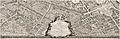
Gallery
A small sample of maps in the collection.
-
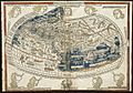
World Map by Claudius Ptolemy, 1482
-
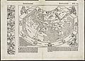
World Map by Hartmann Schedel, 1493
-
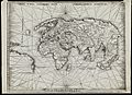
World Map by Martin Waldseemèuller, 1513
-
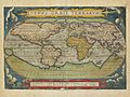
World Map by Abraham Ortelius, 1570
-
Paris by Louis Bretez, 1739


