
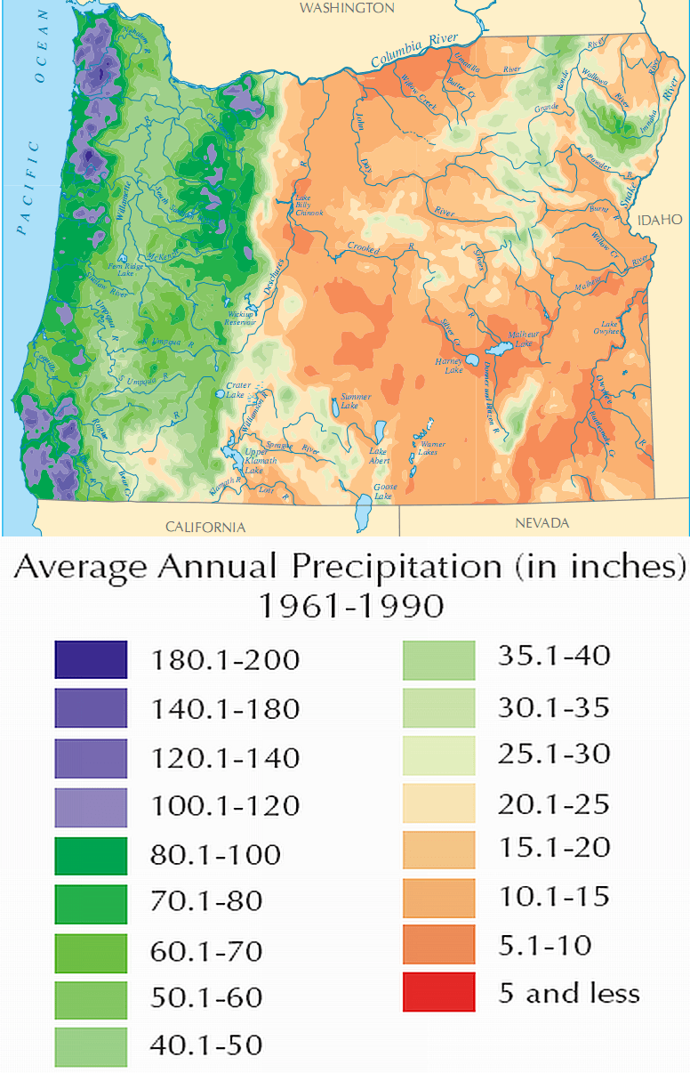
Image: Oregon Average Annual Precipitation (1961-1990) Map
Size of this preview: 386 × 600 pixels. Other resolutions: 154 × 240 pixels | 776 × 1,206 pixels.
Original image (776 × 1,206 pixels, file size: 553 KB, MIME type: image/png)
Description: Map depicting the average annual precipitation (in inches) for Oregon from 1961 to 1990.
Title: Oregon Average Annual Precipitation (1961-1990) Map
Credit: Cropped, re-sized, and pasted two different works together: http://www.nationalatlas.gov/printable/images/pdf/precip/pageprecip_us3.pdf and http://www.nationalatlas.gov/printable/images/pdf/precip/pageprecip_or3.pdf USGS/DOI copyright policy says its works are public domain: http://www.nationalatlas.gov/policies.html#copyright
Author: TimeClock871
Usage Terms: Public domain
License: Public domain
Attribution Required?: No
Image usage
The following page links to this image:

All content from Kiddle encyclopedia articles (including the article images and facts) can be freely used under Attribution-ShareAlike license, unless stated otherwise.
_Map.png)