
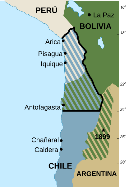
Image: Pacifico1879

Size of this PNG preview of this SVG file: 415 × 600 pixels. Other resolution: 166 × 240 pixels.
Original image (SVG file, nominally 570 × 824 pixels, file size: 51 KB)
Description: Mapa de las fronteras entre Bolivia, Chile y Perú actuales y anteriores a la Guerra del Pacífico de 1879. Versión vectorizada en español. Basado en Image:Borders-Bolivia-Chile-Peru-Before and after Pacfic War of 1879 SP.png
Title: Pacifico1879
Credit: Own work
Author: User_talk:Ummowoa
Permission: Public domain
Usage Terms: Public domain
License: Public domain
Attribution Required?: No
Image usage
The following 2 pages link to this image:

All content from Kiddle encyclopedia articles (including the article images and facts) can be freely used under Attribution-ShareAlike license, unless stated otherwise.