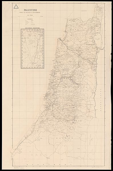
Image: Palestine, Index to Villages & settlements, 1-250,000

Description: The standard single-sheet administrative map issued by the Survey of Palestine, showing boundries of distrcits, subdistricts, and villages/settlements, as well as main roads and railways. Maps in this series were printed since 1933 or earlier, usually in this scale or at 1:150,000. Inset: Southern Palestine, 1:1,000,000.
Title: Palestine: Index to Villages & settlements, 1:250,000
Author: w:Survey of Palestine
Permission: This work created by the United Kingdom Government is in the public domain. This is because it is one of the following: It is a photograph taken prior to 1 June 1957; or It was published prior to 1973; or It is an artistic work other than a photograph or engraving (e.g. a painting) which was created prior to 1973.HMSO has declared that the expiry of Crown Copyrights applies worldwide (ref: HMSO Email Reply) More information. See also Copyright and Crown copyright artistic works.
Usage Terms: Public domain
License: Public domain
Attribution Required?: No
Image usage
The following page links to this image:

